Svalbard refers to the archipelago made up of two main islands, Spitsbergen and Nordaustlandet, plus numerous smaller ones, lying between about 77°N and 80°N. Halfway to Svalbard from mainland Norway is Bjørnøya, an island which lies between 74°20’N and 74°30’N.
Why
A voyage to Svalbard is a unique high-Arctic adventure. Nowhere else can such high latitude—only 600 miles from the Pole—be reached by a boat in such generally moderate weather conditions and usually without serious danger or difficulty from ice.
Bjørnøya
Bjørnøya (Bear Island), although in some respects very bleak and desolate, has a unique beauty and exotic appeal that make it well worth exploring. The coastline teems with seabirds and the towering black rock cliffs and eroded stacks create an eerie scene. There is even a sea cave.
Bjørnøya is populated only by the small staff of the meteorological station located there.
Spitsbergen and Nordaustlandet
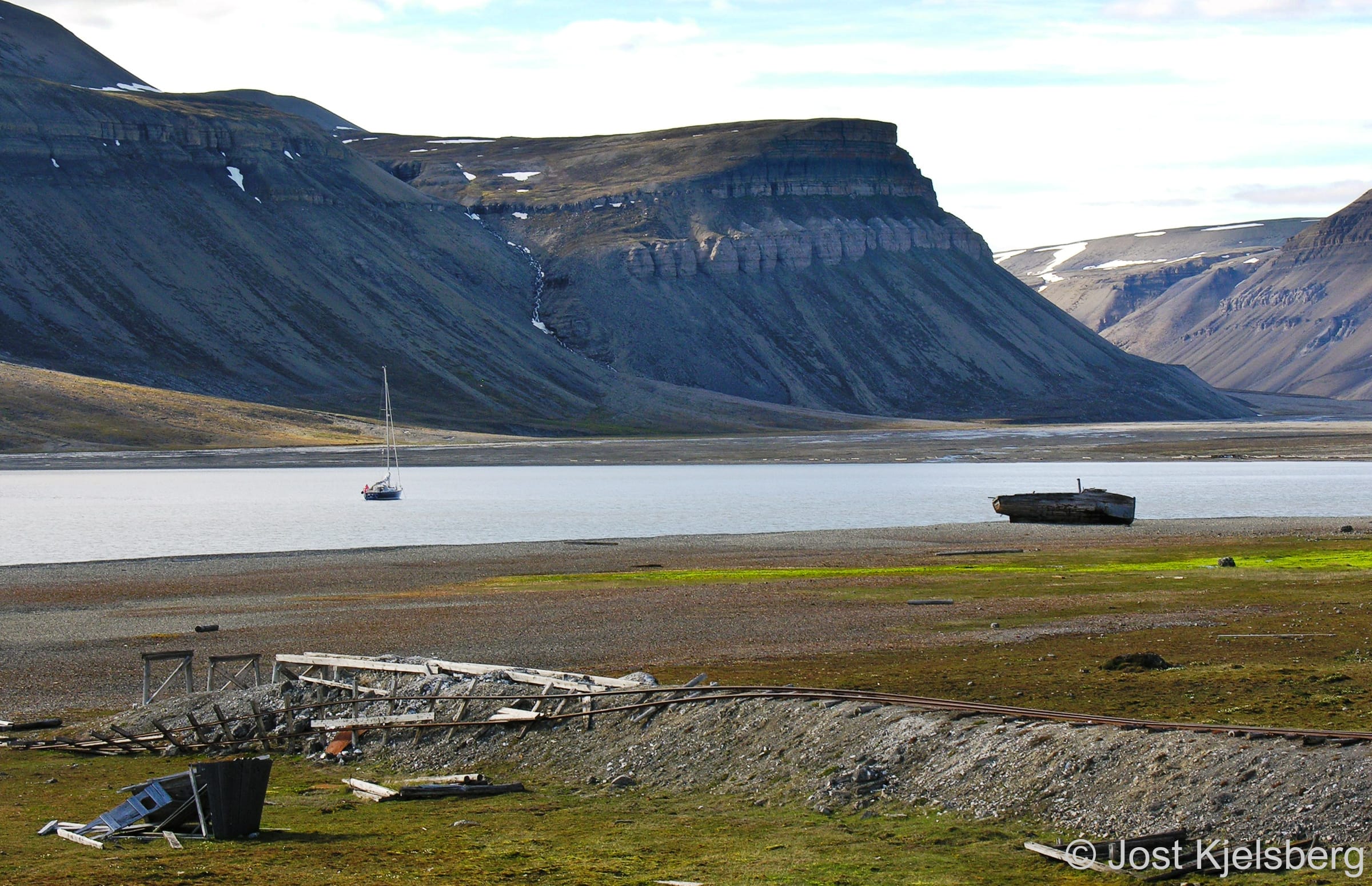
Spitsbergen and Nordaustlandet’s coasts are cut by deep fjords, which offer many anchorages, often with beautiful blue glacier ice drifting about. The scenery encompasses hundreds of square miles of icecap dotted with jagged mountain peaks and the foreground often includes a glacier face several miles wide with a beautiful ice-cliff many mast heights high.
There are myriads of sea and migratory birds—including the arctic tern, which, as the bird with the longest migration of any species, enjoys both the Arctic and Antarctic summers. There are polar bears, foxes, seals, walrus, reindeer and whales.
Although there are approximately 2500 Norwegian, Russian and Polish residents on the island of Spitsbergen, they are concentrated in Longyearbyen and Barentsburg. Other than that, Ny Ålesund has anywhere between 40 and 150 inhabitants and the Polish Research Station at Hornsund about eight. There are also a few huts used by trappers and officers from the Sysselmester (the body that administers Svalbard) dotted around.
The thousands of tourists visiting annually by cruise ship and airplane are also concentrated in a few areas. Though you may end up sharing a fjord with a cruise ship, most of the time you will be alone.
How
The most common route to Svalbard is via Tromsø, where final provisioning and fueling can be done and weather and ice information collected, with offshore departure from Torsvåg.
From Torsvåg the distance to Hornsund is 450 nm. Sailing further east/northeast toward Nordkapp before departing offshore saves no significant offshore mileage. With a moderate increase in the offshore distance, you can sail directly from Lofoten or Vesterålen.
Although Bjørnøya has no all-weather harbours, there are anchorages on all sides of the island and suitable shelter can generally be found in inclement weather. Bjørnøya breaks the voyage into roughly two two-day legs.
Ocean Currents
Ocean currents on the passage to Svalbard seldom exceed one knot but are quite complex:
North of Torsvåg the current sets mostly northeast, with eddies.
South of Bjørnøya the current generally sets northeast.
West and northwest of Bjørnøya the current sets north, up the west coast of Spitsbergen. This is a branch of the North Atlantic current and is responsible for Svalbard’s warmer climate compared to other polar regions at the same latitude.
The waters surrounding Bjørnøya may be disturbed by tidal eddies for some distance offshore and are often rough and dangerous in severe weather.
The current which sets south along the southeast coast of Spitsbergen sweeps west around Sørkapp to join the north-setting current and is the major contributor to pack ice (often with polar bears riding along) on the southwest and west coasts of Spitsbergen early in the year.
Where
Though the majority of sailors limit their cruise to the relatively benign and somewhat populated west and northwest coasts of Spitsbergen, with maybe a quick jaunt up to Moffen Island at 80°N, the reduction in pack ice and improvement in charting are encouraging more sailors to carry on east.
However, the north coast of Spitsbergen and all areas to the east are virtually uninhabited and much more isolated than west Spitsbergen. Ice conditions here are more dangerous as the unwary can be caught between the pack ice and the land. Navigation is also more difficult as much of the area has not been thoroughly charted. Only the experienced and extremely well prepared should attempt to cruise in these areas.
Pack ice north of Nordaustlandet, looking towards Sjuøyene
With the reduction in sea ice, it is now possible in most years to transit Hinlopenstretet and even circumnavigate the entire archipelago
When
Bjørnøya and the west coast of Spitsbergen are generally free of extensive pack ice from June to November.
Starting in mid-August, the likelihood of experiencing severe weather increases. By waiting too long to leave, you risk being forced into a memorably unpleasant passage south.
The information below is in addition to that presented in the Norway Preparation chapter; some of which also applies to Svalbard.
Most of Svalbard is protected and there are numerous regulations that govern where you can travel and what you can do when you get there. We highly recommend you start your research well ahead of time, as much as a year ahead, especially if you plan to hire a firearm for your voyage.
We must emphasize that a small boat voyage to within 600 miles of the North Pole is a serious undertaking, requiring a boat and crew capable of coping with the extreme conditions the high Arctic can present at any time.
Ocean Passage
The passage to Spitsbergen, across the Barents Sea via Bjørnøya, though less difficult than those to Greenland or Antarctica, is not one to take lightly and boat and crew should be prepared. The waters between Norway and Svalbard are generally rougher than you would expect from the wind strength alone and a somewhat lumpy passage is usual.
Logs
There are a significant number of logs, sometimes as large as 1 m in diameter and 10 m long, floating in the Barents Sea and in the coastal waters of Svalbard. These logs are very difficult to see unless it is quite calm, even if you keep a close lookout. They constitute a hazard which you must accept when sailing these waters.
Cold
The cold will place stress, both physical and psychological, on you and your crew. You may have to shorten watches in really cold weather or have two on watch at a time in areas of dense ice or in fog. Except in very secure anchorages, an anchor watch for ice is often necessary, meaning a long stretch of nights of broken sleep.
Cold and exhaustion, particularly if sea sickness is thrown in for good measure, can be a dangerous combination, leading quickly to hypothermia.
Isolation
Traveling in a place with very few services for boats and where you might not see another person for an extended time can also cause stress for you and your crew.
An accident or bad weather may be much more serious and frightening in an Arctic environment than when it occurs in a place with services and support.
Weather
The weather in Svalbard, as in any high Arctic environment, is highly variable and can change rapidly from benign to dangerous.
Ice happens quickly! An early morning scramble to get out of the ice in Signehamna
Cold air is denser than warm air and therefore the wind will feel stronger for a given speed than in more temperate latitudes.
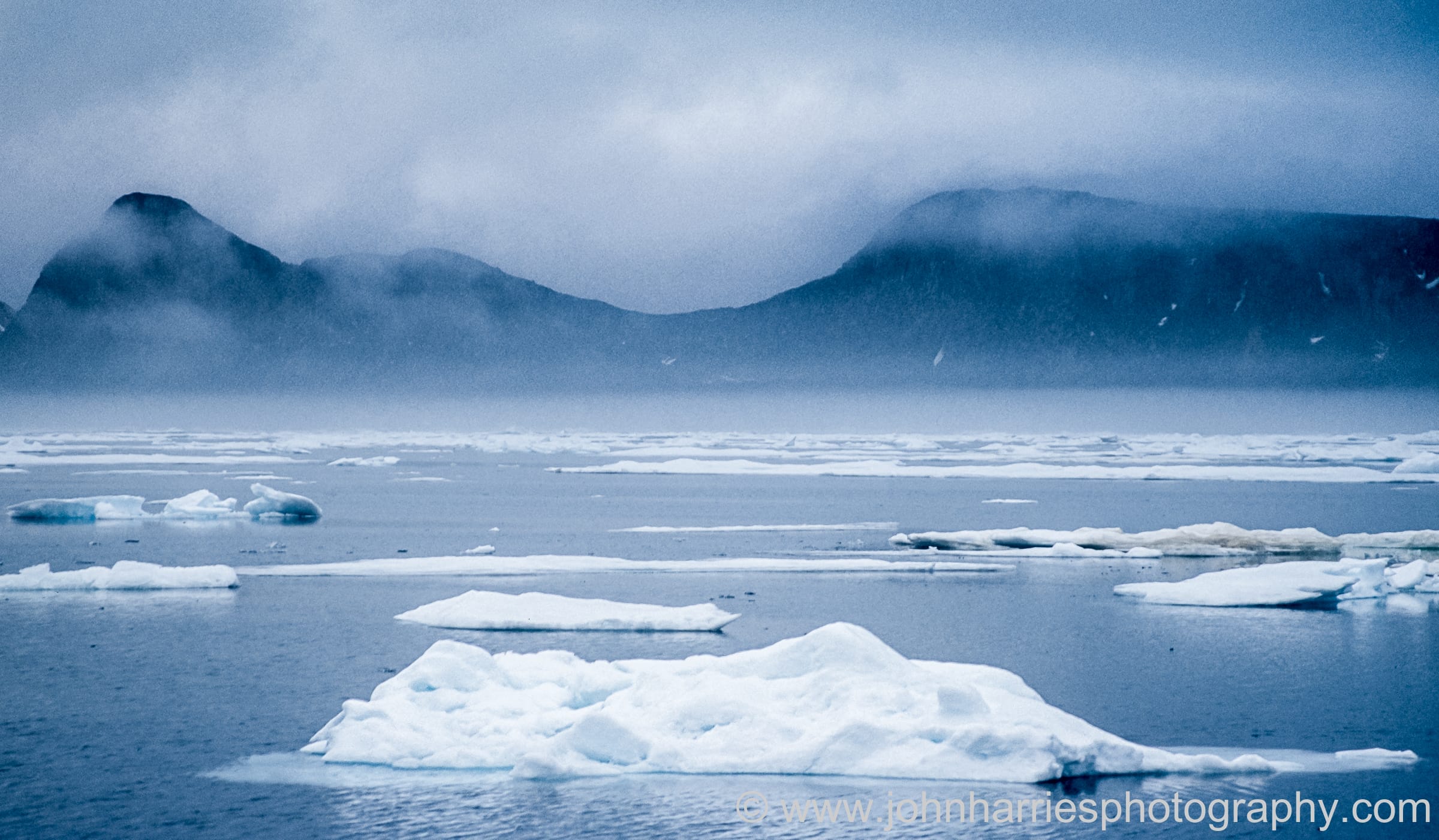
Ice
Ice conditions can change rapidly and become dangerous without warning, even on the relatively benign west coast of Spitsbergen. “Ice happens quickly,” as Willy Kerr, a very experienced high latitude sailor, declared.
For the passage to Svalbard, your boat must be well found and able to handle a tough ocean crossing of several hundred nautical miles. There are virtually no services for boats in Svalbard and so you must be self-sufficient in maintaining and fixing anything that goes wrong with your boat.
Anchoring Gear
We recommend the Spade anchor, which can push through the thick kelp often found in Svalbard anchorages.
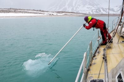
Ice Poles
The ice pole is an important tool in the Arctic
As is shown in the picture, a boathook can do secondary duty as an ice pole; however, wooden dowels are another option if you prefer not to risk your boathook. We carry 2 dowels that we keep tied to the inside of the stanchions when not in use:
Length 4.25 m
Diameter 4 cm
When at anchor, it is gratifying to see how big the pieces are that you can push away. Amazing, that is, until you realize that in most cases you are actually moving the boat, not the ice! When tied to a wharf, however, the size of piece it is possible to move decreases dramatically.
Navtex
A Navtex receiver is good for acquiring weather reports that are, by international convention, broadcast in English, as well as information on ice conditions. However, if you don’t already own one, it may not be a necessary purchase if you have some form of satellite communication. But, on the other hand, Navtex sends out important and possibly time critical Notices to Mariners that you would not otherwise receive unless you went looking for them (and who actually does that?!).
The Barents Sea between Norway and Svalbard is known for fog, so having a radar on board and knowing how to use it will make your trip much less stressful.
The Sysselmester (The Governor) strongly recommends that boats have a VHF radio and a satellite phone when cruising in Svalbard. Note that Svalbard lies outside the footprint of many satellite communications systems, including Globalstar and several of the Inmarsat systems; however, Iridium works fine, in fact better than it does in the lower latitudes. There are several reports of sailors and locals in Svalbard finding adequate coverage using Starlink. As this is new technology, the usual caveats apply.
If you have an inflatable dinghy, make sure you haul it aboard whenever you are at anchor since a polar bear could chew on it, as happened to a friend of ours in Labrador—twice!
Weather Protection
We found that our dodger was sufficient when combined with cold weather clothing, though on the colder days we did envy those with cockpit enclosures or wheelhouses.
Heater
A cabin heater is necessary for comfort except for those with very rugged constitutions.
Safety Equipment
A boat venturing to the high Arctic should be fully equipped with a wide range of safety equipment. When thinking about what to add, the International Racing Federation Offshore Special Regulations is a good place to look for recommendations.
More on liferafts at Attainable Adventure Cruising
We carry waterproof insulated flotation deck (exposure) suits that are suitable to work in on very cold days, especially if handling shorefasts in the dinghy, as well as full immersion (survival) suits with integral feet and hands for survival situations.
The Governor stipulates that all visitors to Svalbard who are planning to travel outside Management Area 10 should carry an emergency beacon and register the ID number with the office before departure for Svalbard.
Preparing The Crew
When traveling in the Arctic, extra hands can ease the passage-watch and anchor-watch burden—particularly welcome when it is cold.
The decision of how many crew to take rests, of course, on your cruising plans and your level of experience sailing in the high latitudes.
Kitted up for a cold day in Svalbard; as the saying goes, “There is no bad weather, only bad clothing”
When planning crew changes, it is best to avoid setting up tight schedules, which can lead to poor decision making. As the old saying goes, “the most dangerous thing on a cruising boat is a calendar”.
Clothing
Although the temperatures in Svalbard are not as bitter cold as the latitude might suggest, the windchill when underway can be enough to require high-quality foul-weather gear.
Make sure to bring cold-weather clothing, including warm ear and head protection, as well as warm waterproof gloves and insulated waterproof boots.
The information below is in addition to that presented in the Norway Rules and Regulations chapter; some of which also applies to Svalbard.
Norway has absolute sovereignty over Svalbard under a treaty originating in 1920 and The Governor (Sysselmester) in Longyearbyen governs the territory.
Under the treaty, Svalbard may not be integrated as a part of Norway and is a non-military zone. The signatories, especially the Russians who had mining interests in Svalbard at the time of signing, have specified rights under the treaty.
Immigration
Though Svalbard is not part of the Schengen agreement, passport requirements are the same as for the rest of Scandinavia and no additional visa is required. Happily, days spent in Svalbard do not count towards the 90-in-180-days Schengen limitation.
Customs
There is no Customs clearance into Svalbard but boats are officially required to clear Customs upon their return to mainland Norway.
Note that ordinary import quotas for alcohol and tobacco apply when you return to the mainland.
Search and Rescue Insurance
The Governor requires that all sailboats traveling outside Management Area 10 have approved Search and Rescue (SAR) Insurance. As Management Area 10 only includes areas around Van Mijenfjorden, Isfjorden and Kongsfjorden, you must have your SAR insurance organized before departing the mainland.
You must file an online travel plan form with the Governor prior to your arrival in Svalbard, so they can inform you what level of SAR coverage they require for your intended voyage. We recommend that you start this process several months before your planned departure to give the Governor time to decide what SAR cover they will require and then time for you to obtain the required insurance.
Some possibilities for SAR insurance:
PJ Hayman & Co: They offer a travel insurance policy with a search and rescue clause, but they will only insure residents of the UK who are under 69 years of age.
If Europeiske: They will insure you at a premium of 10% of the guarantee sum as stipulated by The Governor. Though the insurance details are only available in Norwegian, they will insure international travellers and non-If customers. At the time of writing the insurance does not have an upper age limit.
Pantaenius: Pantaenius is a Danish-based yacht insurance company and they offer SAR insurance under their Personal Accident Policy for those already insured with them.
Garmin: We know the Governor has accepted this coverage on at least one occasion. You will need an insurance plan for each crew member.
An alternative to SAR insurance is to supply a bank guarantee equivalent to the insurance sum required by the Governor.
Polar Bears (Isbjørner)
There are about 300 polar bears in Svalbard, with more in the Barents Sea population, so the chances are good of seeing a polar bear anywhere in the archipelago.
If you come across a polar bear in or near Longyearbyen, call 112 immediately
Polar bears are beautiful, majestic and amazing animals
Polar bears are curious, relatively fearless, and totally unpredictable as they can change instantly from curious to aggressive. Signs that show a bear is under stress are:
flattened ears
turning away
hanging lips
yawning
Heightened aggression may be indicated by:
front foot stamping
growling
brief charges
However, there are times when a bear may initiate a charge without any of these indicators.
Bears can move unbelievably quickly on land and may swim faster than you can row a dinghy. They are used to leaping out of the water and onto an ice floe to grab a seal in one swoop, so the leap onto the deck of a boat is not beyond their capability.
In fact, when Carl Emil Pettersen circumnavigated the archipelago in his Colin Archer vessel Rundø in 1972, he had a polar bear jump on deck from an ice floe. Pettersen just managed to slam the heavy companionway shut as the bear was charging him. The claw marks on the companionway were clearly visible and cherished until the vessel was sunk by ice off East Greenland a few years later.
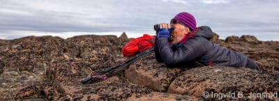
It is paramount to keep a vigilant lookout for polar bears when ashore, they can be difficult to spot, especially in broken ground
Having to shoot a polar bear would be a tragedy, so keeping a good lookout, especially in broken ground, is vital. If a polar bear is spotted, leave the vicinity as quickly as possible, but do not run. Never move towards the bear, not even to take a photograph!
The use of bear spray (Section 4.2) is not permitted
Pyrotechnics
In order to scare off a bear, the Governor mandates deterrents such as a flare gun and thunder flashes. Since polar bears live on pack ice and so are used to loud shot-like noises, it may be that the flash will cause more consternation than the thunder.
Flare gun cartridges may bounce before exploding and so could actually bounce behind the bear and drive it towards the shooter, therefore practice with your flare gun is highly recommended.
Polar bear protection, including a spare dinghy, thunder flashes, flare pistol and rifles
The Governor suggests placing trip flares around the perimeter of a campsite. Placing them around the dinghy while off hiking could deter a polar bear from shredding it. (Another option is to bring a small inflatable dinghy ashore as a backup in case the primary dinghy is damaged.) It would be really unfortunate to be marooned on land without a dinghy with the boat anchored 400 m away in icy cold water.
As part of the application for a non-Norwegian, you will need to have the lender’s information, a copy of your passport, documentation showing you are experienced with handling a firearm, and a good conduct report from your local police.
At time of writing the online form is only usable for Norwegian citizens, so you will have to contact The Governor by email or telephone.
Needless to say, this process should be initiated many months before your planned departure.
If you are going to rent a firearm in Longyearbyen, going ashore outside Management Area 10 prior to obtaining your deterrents is not only potentially dangerous, it may be in contravention of the regulation requiring you to carry the appropriate means to frighten off polar bears.
estimated energy of at least 2,200 joule at a distance of 100 meters
Note that semi-automatic assault rifles, automatic shotguns, and large pistols are illegal, except the latter for residents of Svalbard.
To temporarily import a firearm into Norway, the Norwegian Police’s temporary firearms importation application form (in Norwegian only) mandates that you must have documentation showing an invitation to a shooting competition or showing access to hunting terrain. Though not listed on the form, The Governor’s certificate approving your voyage to Svalbard should serve. We suggest you start this process well in advance of your planned departure for Norway.
If you are a resident of a non-EU/EEZ country, you are required to have a firearms licence from your country of residence or an official declaration stating that a licence is not required in your country of residence.
If you live in the EU/EEZ, your firearm is registered in your name, and you have an EU firearms pass, you technically don’t need a Norwegian Police firearms licence. However, as the Customs Importation Declaration form (see below) requests the police licence, we recommend that you don’t assume anything and investigate the matter thoroughly.
On arrival in Norway you will need to present the import licence to Customs and you will be required to fill in a Customs Importation Declaration form. You do not need to reapply for Svalbard, but you do need to follow storage and transport regulations, as The Governor has been known to check that firearms are appropriately stored.
Protocol
Polar bears have been protected from hunting in Svalbard since 1973 and harassment of one is a serious offense. Shooting a bear in self-defense should be done only when there is no alternative to protect human life. Large fines have been imposed in cases of shootings that were deemed avoidable. An experienced local guide suggests that shooting at a range longer than 30 m is likely to be considered unjustified.
Protection of property is not usually considered justification for shooting, though there may be exceptions to this. The regulations on this read: “Animals may be killed in circumstances where this is considered necessary to eliminate an immediate risk to a person’s life or health or prevent substantial material damage.” [Emphasis added] (Svalbard Environmental Protection Act, Section 33)
If you must shoot, the chest or shoulder is the best place to aim since the bear’s head is so small. Follow immediately with another shot. Polar bears have a very slow metabolism, meaning that it takes a long time for their heart to stop even after being fatally shot.
Any shooting of a bear must be reported immediately and all parts of the carcass belong to the state.
The landscape and ecology of Svalbard are extremely fragile and there is little vegetation to hide scars. As the reproductive rates of the flora are low, it takes many years before disturbance to the soil is obscured by weathering.
Although there are areas in Svalbard where severe damage has already been done, in some cases in recent years and by sanctioned activities, most areas away from the few inhabited centres are relatively pristine.
A high level of attention is focused on avoiding further damage and on repairing existing damage when possible. Official policy is to discourage the development of mass tourism and to actively control and concentrate tourist activity. Regulations are designed in the hope that visitors leave no traces behind them.
An environmental fee is charged for each person on the boat, which goes into the Svalbard Environmental Protection Fund.
Permafrost has pushed this whaler’s grave to the surface; regulations mandate that it should be left as found
It is important that mariners adhere to these regulations. Every instance of protocol violation or poor seamanship requiring official intervention increases the likelihood of restrictions which could reduce future recreational boat access to Svalbard.
The Governor will provide you with a comprehensive list of environmental regulations in force when you apply to visit Svalbard, including what the area restrictions are at the time, but a brief overview of the main regulations follows:
Diving terns are seriously intimidating
Animals and nests should not be disturbed.
To moderate fierce diving attacks by arctic terns, hold a stick overhead to give them a diversionary target; it is, however, prohibited to strike at them.
There are areas with access restrictions, which, as you can see from the map, is all of the archipelago outside of Management Area 10, as well as Bjørnøya. Of primary concern for boats is the exclusion of human activity:
within 300 m of all of the Bird Sanctuaries between May 15th and August 15th
within 300 m of Moffen between May 15th and September 15th
within 500 m of Kong Karls Land all year round
within 1 nm of the south coast of Bjørnøya between April 1st and September 1st (boats > 40′ only). Passage to seek shelter in an emergency is permitted.
There are cultural heritage sites with a total ban on traffic, though special permission may be obtained from The Governor to visit Virgohamn, or with access restrictions to historic remains with the anchorage still accessible. Any artifacts or evidence of earlier human activity, including old whale and walrus bones, should be left as found.
Flying drones is heavily regulated. The regulations are actively enforced and any resulting fines may be substantial.
Flying drones is prohibited within 5 kms of the airport in Longyearbyen
Flying drones is prohibited within 20 kms of Ny Ålesund, which means it is prohibited throughout Kongsfjorden
Drones must not disturb wildlife, hence flying anywhere near breeding birds is not allowed
Flying drones within 12 nm of the shore at Bjørnøya is not allowed as of 2024
Flying drones in nature reserves in Spitsbergen will not be allowed as of 2025 (which translates to most of the archipelago)
The information below is in addition to that presented in the Norway Navigation chapter; some of which also applies to Svalbard.
Charts and Publications
Paper Charts
Svalbard is constantly being re-surveyed and charts are being revised and newly published. In later years there has been a focus on waters near retreating glaciers. However, parts of many charts are still based on old surveys, so beware! Kartverket states that caution should be exercised in water depths less than 50 m and that areas with water depths less than 3 m will not be re-surveyed. Since most paper charts are 1:100,000 and electronic charts are based on these, Kartverket warns against “over-zooming”.
Datum Errors
All charts printed after 1992 are WGS-84 datum and can be used with your GPS without adjustment. Charts based on older datums will have longitude values that are inaccurate, making it dangerous to rely solely on GPS positions.
Electronic Charts
If you are bound for Moffen Island, Hinlopenstretet or Nordaustlandet, make sure your charts cover this area, as some electronic charting companies only have coverage up to 80°N. If this is the case, you will need to get paper charts to cover the gap.
Topographic Maps
Navigating north of Nordaustlandet using a topographical map
Svalbard has been extensively mapped topographically at 1:100,000 and at 1:10,000 in a few areas. These maps may be useful for venturing ashore and are also useful for navigating in the relatively uncharted waters of Nordaustlandet, Barentsøya and Edgeøya, even though they have no soundings.
The Norsk Polarinstitutt sells printed copies online. You may also be able to purchase them in one of the shops in Longyearbyen.
You can also view the topo maps of Svalbard online, and we have provided a link to these online maps for each Svalbard harbour/anchorage entry.
Sailing Directions
A list of sketch maps for Svalbard produced by Den Norske Los (no longer being updated as of 2018)
We highly recommend the very fine Arctic sailing directions and visitors’ guide, Den Norske Los, Vol. 7, for both its detailed pilotage and its extensive general coverage of history, climate, ice, flora and fauna, geology and weather.
Vol. 7 is published in both Norwegian and English. It is now only available online as a PDF, and is not integrated into Kartverket online charting as the DNL volumes for mainland Norway are.
This volume has not been updated since 2018
Tides and Tidal Streams
Tidal streams around Svalbard are generally moderate except to the east of Spitsbergen, but when added to currents, the net speed can sometimes reach two knots even in open water.
The standard port used when describing tides is Longyearbyen but, as far as we know, the only tidal gauge for the island group is in Ny Ålesund.
Compasses
As you progress north along the west coast of Spitsbergen, a magnetic compass will probably become more and more sluggish, perhaps even useless around 78°N. Fluxgate compasses may be affected less. Autopilot compasses may also be affected, producing sluggish or erratic performance, particularly on northerly courses.
The information below is in addition to that presented in the Norway Communications chapter; some of which also applies to Svalbard.
VHF and SSB
For the first part of the passage to Svalbard you will be in VHF range of relay stations monitored by Coastal Radio North in Bodø. As you get closer to Bjørnøya you will again be able to communicate with Coastal Radio North relayed through an antenna on Bjørnøya, and then, as you approach Hornsund, the Polish Polar Station can be called on VHF.
There is a gap in VHF coverage between the Polish Polar Station and Coastal Radio North’s relay antenna at the mouth of Isfjorden.
Once out of range of their aerial at Ny Ålesund, only SSB MF will be useful, communicating with Coastal Radio North relayed through antennae on Spitsbergen and Bjørnøya.
Mobile Phones
There is mobile phone coverage for most of Isfjorden, around Ny Ålesund, and for N Bjørnøya, if you can access Telenor towers, but check your plan and make sure the roaming charges won’t bankrupt you.
When deciding whether to carry a satellite phone or rely on emergency beacons and VHF, consider that, in the case of an emergency, rescuers will be able to communicate with you directly on a satellite phone, which they won’t be able to do with the others (except on VHF when very close by).
Iridium is the only one of the mainstream satellite phone systems that provides complete coverage to the high latitudes due to their polar-orbiting satellites.
People with cabins outside the settlements in Svalbard were early adopters of Starlink. They have their antennaes at their cabins during winter and move them aboard their boats for the summer cruise.
At least one boat sailing with paying customers uses Starlink, giving their passengers the online access that many feel necessary for daily life. A cruising boat on a seasonal cruise may find that the investment, complexity and power requirements are not worth it.
The information below is in addition to that presented in the Norway Weather and Weather Forecasts chapter; some of which also applies to Svalbard.
Weather conditions in the high Arctic can change dramatically from year to year and your crew and boat must be prepared for whatever conditions are encountered, which could be anything from warm, clear and mildly windy weather to a great deal of cold fog, snow and very strong winds.
The winds in the area during June, July and early August are generally moderate, but there may be exceptions. Local topography has a great effect, with an extreme variation in wind strength and direction found over a short distance. Fallvinder (williwaws or katabatic gusts) are prevalent at the base of high mountains and below the icecap.
During the latter half of August the weather usually becomes less settled and more severe.
Since mobile phone reception is only available in the area around Isfjorden and in Ny Ålesund, you are deprived of that valuable method of receiving English language forecasts, making Navtex even more desirable than it is in Norway. A good Navtex receiver will pull in forecasts during the voyage to Svalbard and throughout the archipelago.
Broadcast Radio
For those who can understand some Norwegian, forecasts on mediumwave 1485 kHz from the transmitter in Longyearbyen can be received in parts of the archipelago.
DAB+ is available around Longyearbyen.
Public radio can also be accessed through the 4G/2G Telenor networks in N Bjørnøya, Longyearbyen and Ny Ålesund.
Bjørnøya Meteo broadcasts weather forecasts in English for the sea area between Bjørnøya and Sørkapp at 1005 and 2205 UTC on VHF channel 12; an announcement is made on channel 16.
Weather forecasts in Norwegian for coastal waters (including Spitsbergen) are broadcast over VHF relay stations on working channels at 0900, 1200, 1500, 1800 and 2100. These will be available for large parts of the west coast of Spitsbergen. Weather forecasts in English will be provided upon request.
Forecasts from Bjørnøya Meteo are also available on MF. Coastal Radio North also read out weather forecasts for offshore areas in English on MF at 1203 UTC and 2303 UTC.
A properly-installed HF receiver will receive weather faxes from both Germany and the UK but, unfortunately, the UK maps cut off Svalbard. Ironically, if you can download these same UK maps via the internet, Svalbard is included, since the truncation is a result of the fax transmitter’s drum width.
GRIBs
Some GRIB files may cut off at 80˚N so you will need to supplement their information in some way, if you are planning to sail the north or east coasts of the archipelago.
In addition to satellite communication, GRIB files can also be downloaded through the Telenor 4G/2G networks on N Bjørnøya, Longyearbyen and Ny Ålesund.
Weather Routing
If you require professional help with weather forecasts and routing, we recommend Commanders Weather.
The sea (pack) ice conditions in Svalbard are driven by a balance between the warming influence of the last gasp of the north-going Gulf Stream and the polar pack ice drifting down in the prevailing southwest-going current. Wind can also play a large role in pack ice conditions.
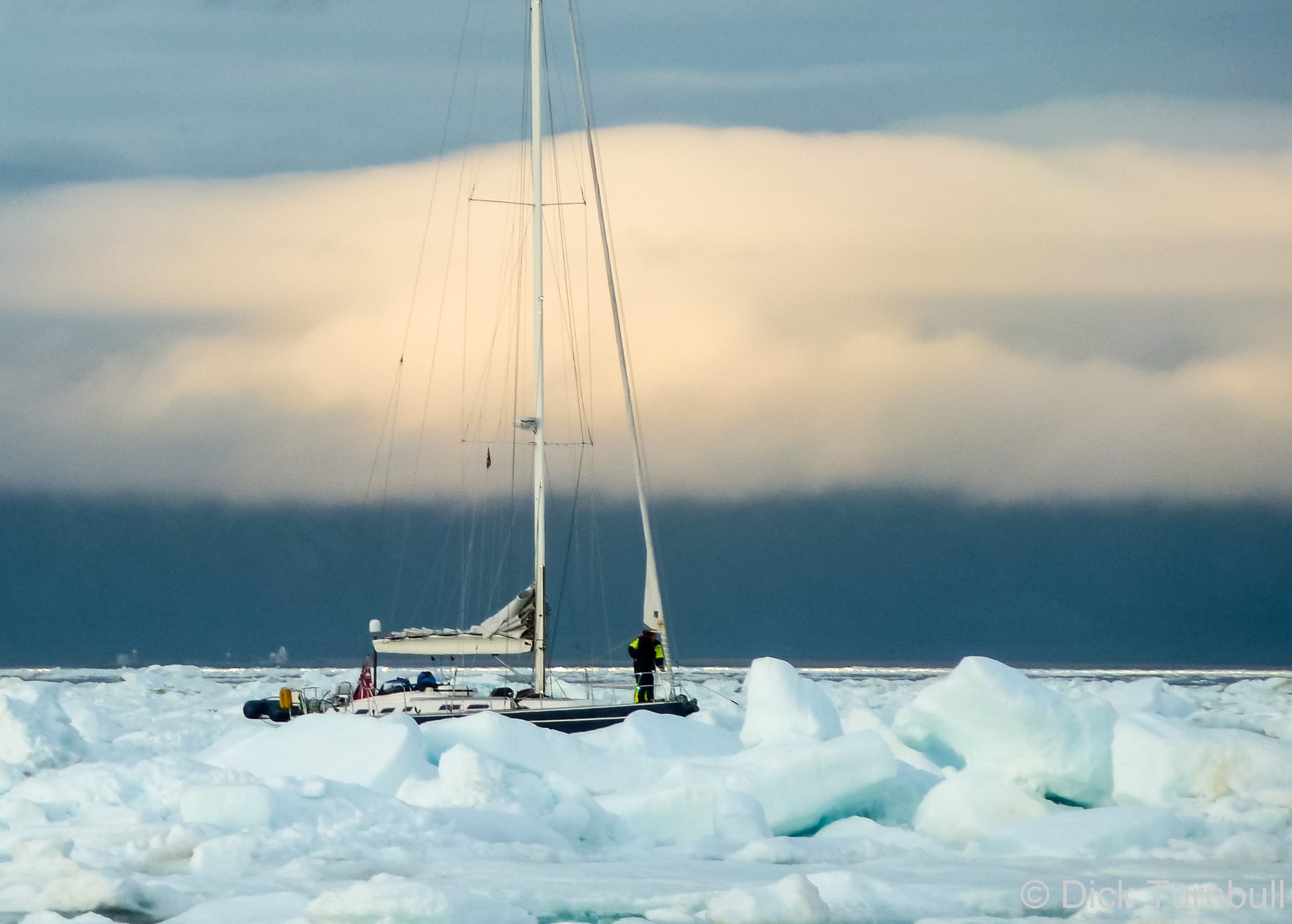
Sailboat manoeuvring through pack ice in Isfjorden, July 24, 2011
Note that ice can move as much as 60 miles a day if driven by wind and current. 30 miles a day is common. If there is ice within 200 nm of your position you should be tracking it carefully.
2011 was one of those exceptional years when pack ice entered Isfjorden, and a number of visiting boats got caught in Longyearbyen in late July. If they had been monitoring the ice forecast, they could have escaped before the ice came in (a skipper who got caught in Longyearbyen by ice expressed this mea culpa in a personal conversation with the authors). The motto? Never relax your vigilance when in potentially icy waters.
the passage from Torsvåg, Norway to Bjørnøya and on to Sørkapp, south Spitsbergen, will be free of ice by early June.
boats that need to leave for Svalbard early in the season should be prepared to make landfall north of Isfjorden since, in some years, a few weeks after the west coast of Spitsbergen clears of ice, the winds may bring new pack ice around Sørkapp from the east, temporarily blocking Hornsund and possibly even Bellsund and Isfjorden.
if bound for the north coast of Spitsbergen, Hinlopenstretet or Nordaustlandet be aware that pack ice can move quickly at any time, driven by the wind and/or current, and trap the unwary in an anchorage or between the ice and the coast. Reliable ice information and a clear understanding of ice drift theory are vital in these areas.
Glacier/Berg Ice
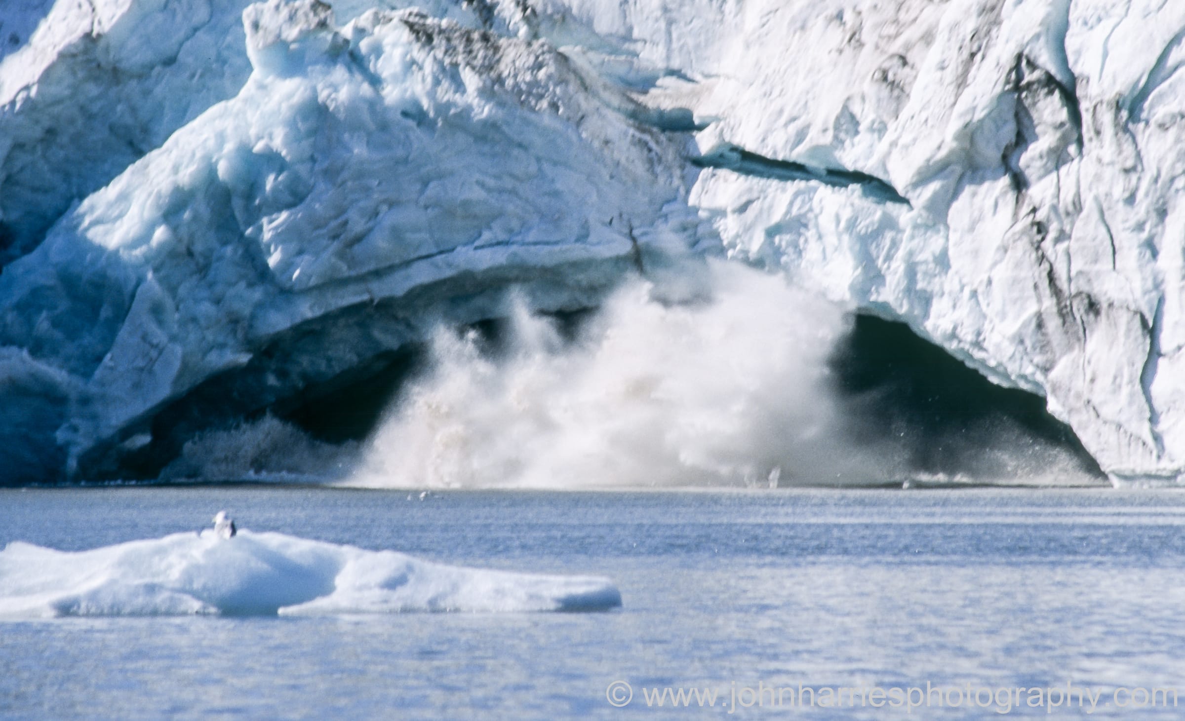
Throughout the summer you will probably find some freshwater (berg) ice, calved from glaciers, in the fjords and anchorages of Spitsbergen, along with a few larger bits drifting along the coast.
This ice is often very beautiful, but its presence does mean that you have to keep a sharp lookout when underway, especially in fog.
It may also enter previously clear anchorages, forcing you to make a middle-of-the-night move; however, with continuous daylight, this is less of a problem than it would be in the dark.
There are places where you can approach quite close to the impressive and beautiful glacier faces, but keep in mind that this is not without risk. In addition to the very real risk that a large piece of ice will fall off the glacier face and produce a large wave, there is also the possibility that one of these big chunks of ice will resurface some distance out from the face.
Walking on glaciers is likely to be dangerous unless you are properly experienced and equipped with crampons, ice axe and rope. Guided glacier excursions can be booked in Longyearbyen.
Berg ice is not an issue at Bjørnøya.
Ice Reports
Via the Internet
The Norwegian Met Office offers Monday through Friday daily ice charts for Svalbard. The ice charts are high-resolution products “…based on a variety of satellite data sources, primarily Synthetic Aperture Radar (SAR) and optical, and provide sea ice concentration as well as delineating areas of fast ice…”.
The Met Office is experimenting with providing short-range sea ice forecasts, gathered from external sources, so with the usual caveats.
Those with satellite equipment should contact Istjenesten (email: ) to request that they send compressed files with relevant ice information, available daily Monday to Friday. You need to supply the date from which you want the ice reports and your email address. This is an automated process, so remember to contact Istjenesten to “unsubscribe” when you return to the mainland.
Via Navtex
Ice edge information, suitable for avoiding ice-infested areas, is broadcast in text via Navtex on the following schedule:
Svalbard (A) 8:00 daily and 16:00 on Tuesdays only
The information below is in addition to that presented in the Norway Stopping chapter; some of which also applies to Svalbard.
Docking
A busy day in Longyearbyen
Docks are only available in Longyearbyen, Ny Ålesund and Barentsburg. It may be possible to tie up at Pyramiden with difficulty.
Anchoring
Ice
Wind speed and direction, and drifting glacier ice conditions, are often extremely local, and a shift of anchorage of even a few miles may bring dramatically different conditions. With no darkness to complicate a move should conditions change, it is possible to use an anchorage which would not feel comfortable on a dark night; however, wind and drifting ice conditions can change rapidly, something to keep in mind if leaving your boat unattended while on a shore expedition. Anchoring in the least depth available will help to limit the size of ice which can drift into the boat.
Bottom Conditions
We had no difficulty getting our 55-kg Spade anchor to set except for in one anchorage at Heleysundet in Hinlopenstretet that had very thin mud. (In this type of bottom no anchor will be able to find purchase but will slowly drag backwards when under load from the engine.)
Many anchorages are foul with thickly-growing kelp. When setting the anchor it is essential that the anchor get stuck into the bottom and not just get caught in a thick mass of kelp. A long, sharp, serrated bread-knife, along with a boat hook, can be useful for clearing kelp from the anchor on retrieval.
We highly recommend having an alternate anchorage in mind in case your initial choice doesn’t work out.
Shelter
The best shelter is found behind low moraine spits, which break the waves without causing gusting of the wind. Anchoring in the lee of high, steep mountains often leads to severe, even dangerous, gusting.
There are good anchorages at Bjørnøya on both the east and west sides of the island; however, they are all open in at least one direction and will rapidly become uncomfortable or dangerous in an onshore wind.
Svalbardbutikken, the grocery store in Longyearbyen, has a good selection. Prices for perishable goods such as milk and vegetables can be nearly twice the mainland price but canned and dried foods and longlife milk may be cheaper.
Alcohol
Tax-free alcohol is available at Nordpolet, which is part of Svalbardbutikken. Visitors can purchase wine freely but must show evidence that they are not residents and therefore not subject to the quota scheme if they wish to purchase beer or spirits.
Ordinary import quotas for alcohol and tobacco will apply when you return to mainland Norway.
Water
It is possible to fill your water tanks alongside the docks in Longyearbyen and Ny Ålesund. We would not recommend that you fill with stream water or drink from streams without filtering the water in some way because of the presence of caribou and the resultant risk of giardia, unless the water is coming directly off a glacier—in which case it is probably full of glacial flour, the ground-up rock that gives streams coming from glaciers their milky colour.
Diesel fuel is available in both Longyearbyen and Ny Ålesund; some years it is cheaper in Longyearbyen and some years in Ny Ålesund! While diesel is also available in Barentsburg, the quality is reportedly variable.
Health
Hospital and dental services are available in Longyearbyen.
Pets
Note that there are strict regulations concerning the importation of pets into Svalbard, including a total ban on cats and ferrets. There may be an exception for dogs on application.
Expedition Support and Chartering
We have no personal experience with any of these companies so do your own due diligence
Boreal Yachting has a base in Longyearbyen and provides skippered voyages in Svalbard.
High Latitudes is an experienced group of high-latitude sailors who can provide full expedition support or an advisory service to assist you in preparing for and running your own expedition.
Seil Norge, based in Ylvingen on the Helgeland coast, organizes skippered sails to Spitsbergen. They claim to be Norway’s “leading organizer of sailing trips, expeditions and sailing courses”.
WayNorth Maritime can assist you with planning your cruise and will also deliver your boat to and from locations in Norway.
Fun and/or Informative Reading
Champagne and Polar Bears: Romance in the Arctic
We met Marie Tièche, the author, and Hauke Trinks, a German professor, at an isolated station on Nordaustlandet, Svalbard, just at the beginning of their 13-month stay there. Marie does a wonderful job of describing their time on Nordaustlandet and the growth of their relationship.
Bear Island
By Alistair MacLean, this is a murder mystery novel written in the early 1970s that takes place on Bjørnøya. It’s a fun read.
Rowing to Latitude: Journeys Along the Arctic’s Edge
Jill Fredston and her husband are avalanche experts in Alaska in the winter. In the summer they row their sculls along various challenging coasts, including those of Norway and Svalbard.
Ice Bears & Kotick: Rowing on Top of the World
This is the story of two young British men who row a traditional open Norwegian boat (oselvar) around Svalbard.
We use cookies on our website to give you the most relevant experience by remembering your preferences and repeat visits. By clicking “Accept All”, you consent to the use of ALL the cookies. However, you may visit "Cookie Settings" to provide a controlled consent.
This website uses cookies to improve your experience while you navigate through the website. Out of these, the cookies that are categorized as necessary are stored on your browser as they are essential for the working of basic functionalities of the website. We also use third-party cookies that help us analyze and understand how you use this website. These cookies will be stored in your browser only with your consent. You also have the option to opt-out of these cookies. But opting out of some of these cookies may affect your browsing experience.
Necessary cookies are absolutely essential for the website to function properly. These cookies ensure basic functionalities and security features of the website, anonymously.
Cookie
Duration
Description
cookielawinfo-checkbox-advertisement
1 year
Set by the GDPR Cookie Consent plugin, this cookie records the user consent for the cookies in the "Advertisement" category.
cookielawinfo-checkbox-analytics
11 months
This cookie is set by GDPR Cookie Consent plugin. The cookie is used to store the user consent for the cookies in the category "Analytics".
cookielawinfo-checkbox-functional
11 months
The cookie is set by GDPR cookie consent to record the user consent for the cookies in the category "Functional".
cookielawinfo-checkbox-necessary
11 months
This cookie is set by GDPR Cookie Consent plugin. The cookies is used to store the user consent for the cookies in the category "Necessary".
cookielawinfo-checkbox-others
11 months
This cookie is set by GDPR Cookie Consent plugin. The cookie is used to store the user consent for the cookies in the category "Other.
cookielawinfo-checkbox-performance
11 months
This cookie is set by GDPR Cookie Consent plugin. The cookie is used to store the user consent for the cookies in the category "Performance".
CookieLawInfoConsent
1 year
CookieYes sets this cookie to record the default button state of the corresponding category and the status of CCPA. It works only in coordination with the primary cookie.
viewed_cookie_policy
11 months
The cookie is set by the GDPR Cookie Consent plugin and is used to store whether or not user has consented to the use of cookies. It does not store any personal data.
wpEmojiSettingsSupports
session
WordPress sets this cookie when a user interacts with emojis on a WordPress site. It helps determine if the user's browser can display emojis properly.
Functional cookies help to perform certain functionalities like sharing the content of the website on social media platforms, collect feedbacks, and other third-party features.
Cookie
Duration
Description
yt-player-headers-readable
never
The yt-player-headers-readable cookie is used by YouTube to store user preferences related to video playback and interface, enhancing the user's viewing experience.
yt-remote-cast-available
session
The yt-remote-cast-available cookie is used to store the user's preferences regarding whether casting is available on their YouTube video player.
yt-remote-cast-installed
session
The yt-remote-cast-installed cookie is used to store the user's video player preferences using embedded YouTube video.
yt-remote-connected-devices
never
YouTube sets this cookie to store the user's video preferences using embedded YouTube videos.
yt-remote-device-id
never
YouTube sets this cookie to store the user's video preferences using embedded YouTube videos.
yt-remote-fast-check-period
session
The yt-remote-fast-check-period cookie is used by YouTube to store the user's video player preferences for embedded YouTube videos.
yt-remote-session-app
session
The yt-remote-session-app cookie is used by YouTube to store user preferences and information about the interface of the embedded YouTube video player.
yt-remote-session-name
session
The yt-remote-session-name cookie is used by YouTube to store the user's video player preferences using embedded YouTube video.
ytidb::LAST_RESULT_ENTRY_KEY
never
The cookie ytidb::LAST_RESULT_ENTRY_KEY is used by YouTube to store the last search result entry that was clicked by the user. This information is used to improve the user experience by providing more relevant search results in the future.
Performance cookies are used to understand and analyze the key performance indexes of the website which helps in delivering a better user experience for the visitors.
Analytical cookies are used to understand how visitors interact with the website. These cookies help provide information on metrics the number of visitors, bounce rate, traffic source, etc.
Cookie
Duration
Description
_ga
1 year 1 month 4 days
Google Analytics sets this cookie to calculate visitor, session and campaign data and track site usage for the site's analytics report. The cookie stores information anonymously and assigns a randomly generated number to recognise unique visitors.
_ga_*
1 year 1 month 4 days
Google Analytics sets this cookie to store and count page views.
Advertisement cookies are used to provide visitors with relevant ads and marketing campaigns. These cookies track visitors across websites and collect information to provide customized ads.
Cookie
Duration
Description
VISITOR_INFO1_LIVE
6 months
YouTube sets this cookie to measure bandwidth, determining whether the user gets the new or old player interface.
VISITOR_PRIVACY_METADATA
6 months
YouTube sets this cookie to store the user's cookie consent state for the current domain.
YSC
session
Youtube sets this cookie to track the views of embedded videos on Youtube pages.