The Recreational Mariner's Guide

This page is only for printing or saving

Volume 1, Section:

2. Norway

  • Why, How and Where

    Why

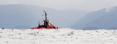
    If you are looking for beautiful scenery, sheltered waters and secure harbours, the Norwegian coastline will suit you just fine. As an added bonus, except for in the most populated areas in the south, the chances are good that you will have that secure anchorage in beautiful surroundings all to yourself.

    And, when you choose to be in a populated place, you will almost invariably receive a warm welcome from Norwegians who are interested in visiting mariners and eager to help make your time in Norway a success.

    Beautiful scenery, sheltered waters, secure harbours, isolated anchorages, and friendly people: It doesn’t get much better than that!

    How

    The six main choices of route we discuss below are based on departure points within the UK; however, they also provide useful information if you are coming from other places in Europe.

    From England Direct

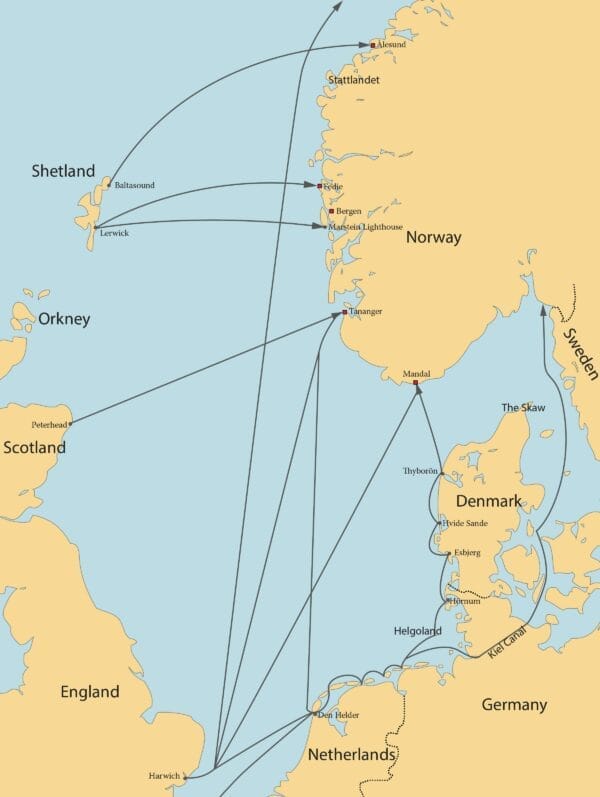
    From Harwich to Tananger (Volume 2)—which is a good place to make landfall if heading north on the Norwegian coast—is about 400 nm. Nearby Skudeneshavn (not an approved Port of Entry) and Stavanger are other excellent landfalls. 

    It is also possible to make a direct 1000-nm passage to Lofoten (Volume 4), bypassing the northeast winds common along the west Norwegian coast in early summer. The great advantage to this route is that there is plenty of sea room all the way and any strong winds will hopefully be on the quarter or, at worst, on the beam.

    From Harwich to Mandal (Volume 2), which is a good place to make landfall if heading to the Norwegian southeast coast, is about 400 nm. Nearby Farsund and Kristiansand also make good landfalls.

    From Scotland Direct

    From Peterhead to Tananger (Volume 2) is about 250 nm. For those on the east coast of England, the distance from Harwich to Peterhead is about 350 nm, so stopping in Peterhead adds about 200 nm onto the actual distance traveled. However, for those coming from the west coast of England or Scotland this could be a good alternative with a transit of the Caledonian Canal. The greatest advantage of this route is that even a northwest wind will be well abaft the beam.

    From Shetland Direct

    From Lerwick to Fedje (Volume 3) is only about 180 nm. From Lerwick to Marstein Lighthouse in the south approaches to Bergen (Volume 2), 42 nm south of Fedje, is only about 190 nm. 

    From Baltasound to Ålesund (Volume 3), which is an all-weather landfall north of notorious Stattlandet, is only about 230 nm. 

    Shetland is not much out of the way on a route from the west UK but may be an unwarranted detour from the east UK. Orkney and Fair Isle provide good intermediate stops but in waters which are strongly tidal and truly nasty in bad weather. Nonetheless, the north Scottish islands do make an interesting destination in their own right and provide good provisioning at UK prices.

    Via The Netherlands

    From Harwich to Tananger (Volume 2) via Den Helder is only 500 nm, so the detour adds only 60 nm to the whole trip but takes 80 nm off the long passage—Den Helder to Tananger being 360 nm. The disadvantage is that a northwest wind leaves you close-hauled at best, and possibly unable to lay the course at all, but there is still plenty of sea room and you can always bear away and run for shelter behind the Skaw. The main main disadvantage of this route are the many offshore windfarms and busy shipping lanes.

    Via The Baltic

    It is possible to reach Norway by the Dutch and German coasts, the Kiel Canal and the Baltic, without ever having to be at sea in the dark. This is a good route if you dislike long passages and have plenty of time, but it’s a long way around.

    Via Helgoland and the Danish West Coast

    While this route requires a watchful eye on the weather, it does provide an interesting route that avoids the rather congested southwest Baltic.

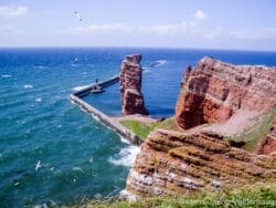
    From Helgoland it is possible to daysail to Thyborön, with stops at Hörnum (Sylt, N Frisian Islands), Esbjerg and Hvide Sande. The long approaches to Hörnum and Esbjerg mean that you may want to spend a day or two extra in these places. 

    Apart from Esbjerg, all harbours on this coast are unapproachable in strong onshore winds, and even Esbjerg should only be approached on a flood tide in these conditions.

    On the passage north from Esbjerg, pass through the well-buoyed Slugen, inside the large windmill farm on Horns Rev. On the passage north of Slugen, pass through Nordmands Dyb, which is lighted.

    From Thyborön, a direct crossing of the Skagerrak to Mandal (Volume 2) on the Norwegian south coast is about 80 nm. Hanstholmen and Hirtshals offer useful boltholes on the Danish northwest coast; departure from either will shorten the crossing to Norway to approximately 60 nm. In unfavourable weather conditions a passage east from Thyborön through Limfjorden offers a scenic and tranquil alternative to bashing about in the North Sea.

    Where

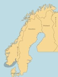
    The Norwegian coast can be roughly divided into three areas by scenery, climate and sailing conditions. Below is a brief introduction to these three areas to help you plan your cruise.

    For more detailed information on the characteristics of various sections of the coast, and for landfall harbours in each of these areas, please see the Introduction to each of the Harbours and Anchorages chapters (Volumes 2, 3, 4 and 5). 

    From the Swedish border to the Russian border is about 1300 nm; if you add fjords and bays it’s about 15,633 nm; if you add islands it’s about 54,489 nm. A lot of coastline, in other words!

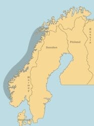
    The Swedish Border to Tananger (Volume 2)

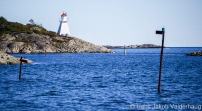
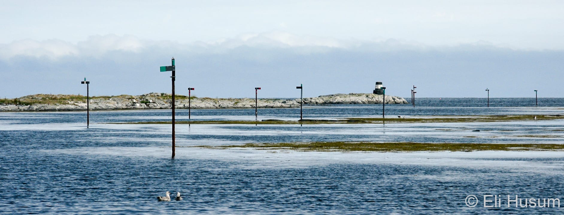
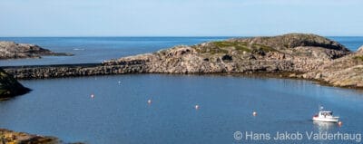
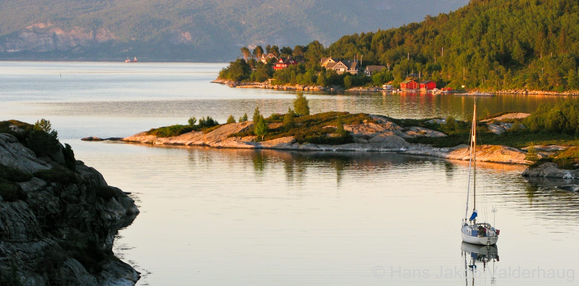
    East of Lindesnes, Norway’s southernmost point, the scenery is one of soft rounded hills covered with deciduous forest. The coast is protected by off-lying islands and almost the entire coast can be navigated inside the skjærgård (off-lying skerries). 

    There is quite a lot of sunshine here as the westerlies, which bring most of the bad weather to the west coast in summer, are broken up by the mountain barrier and, incidentally, emptied of their rain at the same time. 

    The solgangsbris (afternoon sea breeze) can blow quite strongly from the southwest, so on a passage southwards from Oslofjorden, you will want to get off to an early start, taking advantage of the weak offshore breeze that is common at night and in the early hours of the morning. 

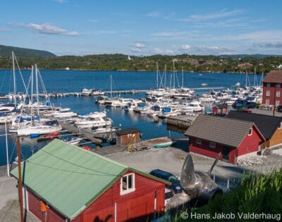
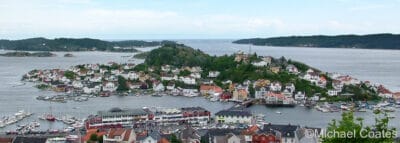
    Harbours and anchorages may be crowded but, on the other hand, there are more facilities geared to pleasure boats.

    Almost half of Norway’s five million people live in this area

    West of Lindesnes, the scenery changes slowly, from the gentle skjærgård to the bleak mountains and exposed coast south of Egersund—an appetizer for the dramatic west-coast scenery that is waiting around the corner. 

    Once north of Egersund, the coastline again flattens out but there is no protection from the sea until you enter the skerries again at Tananger.

    Tananger to Lofoten (Volumes 2, 3 and 4)

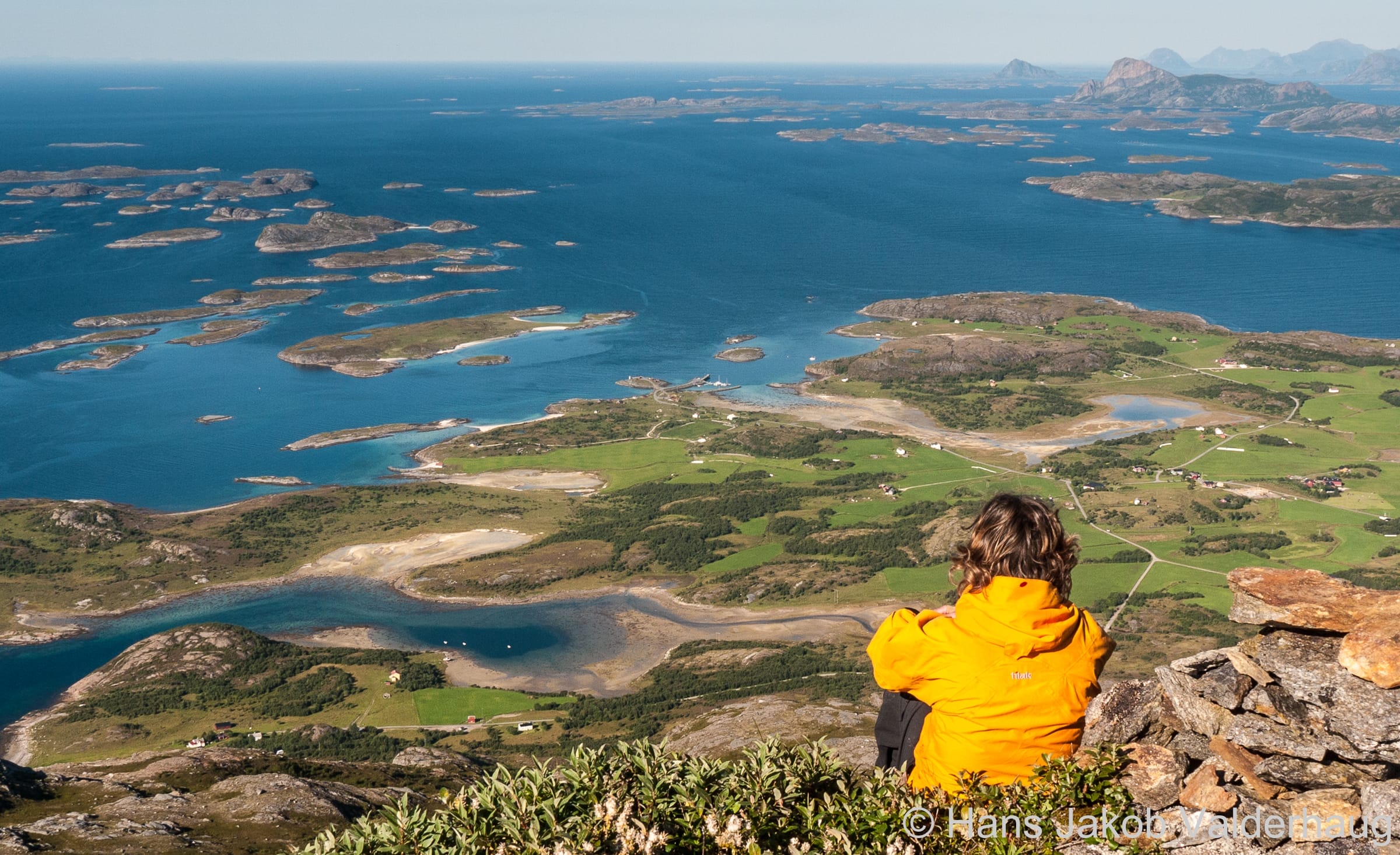
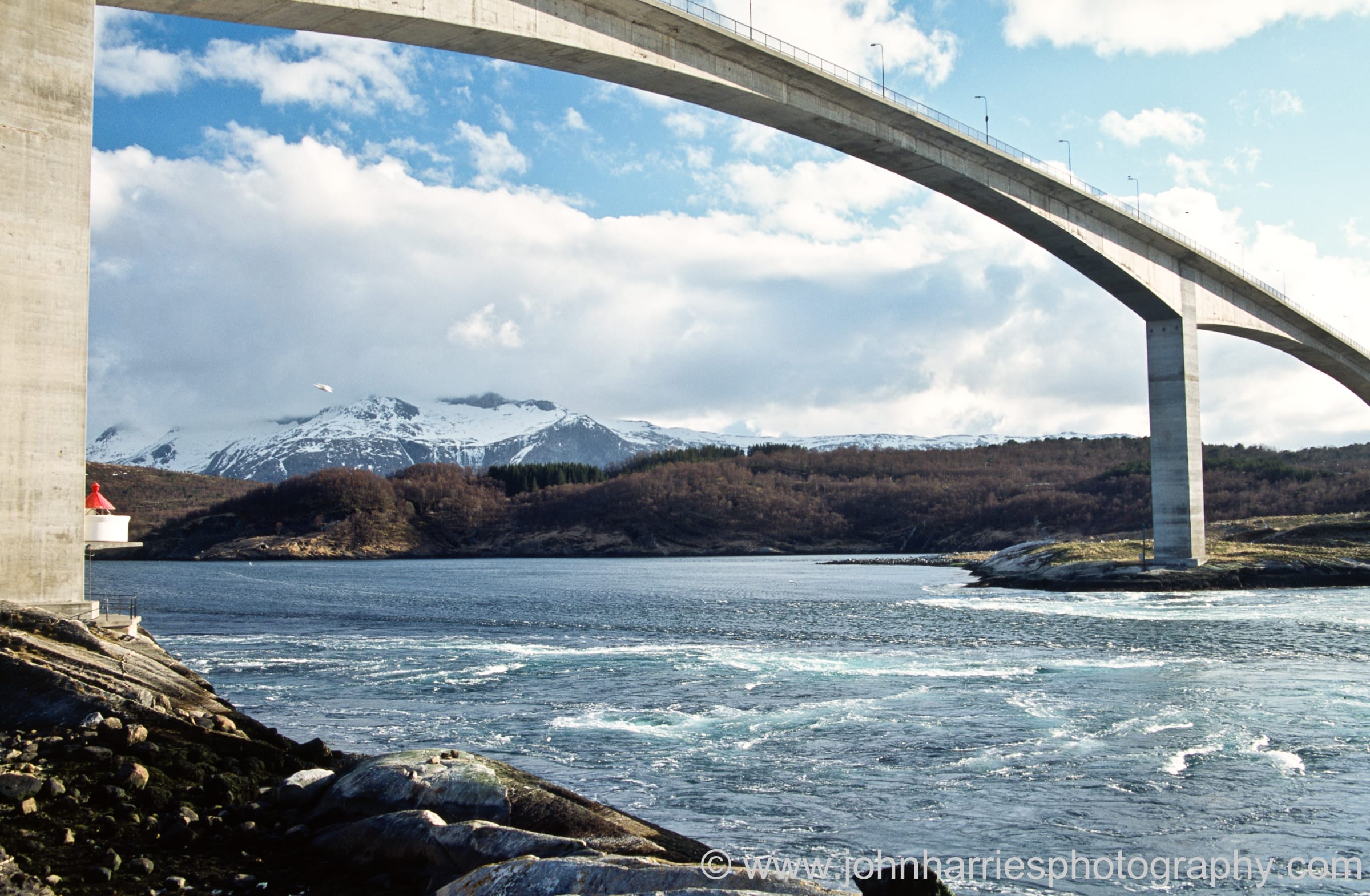
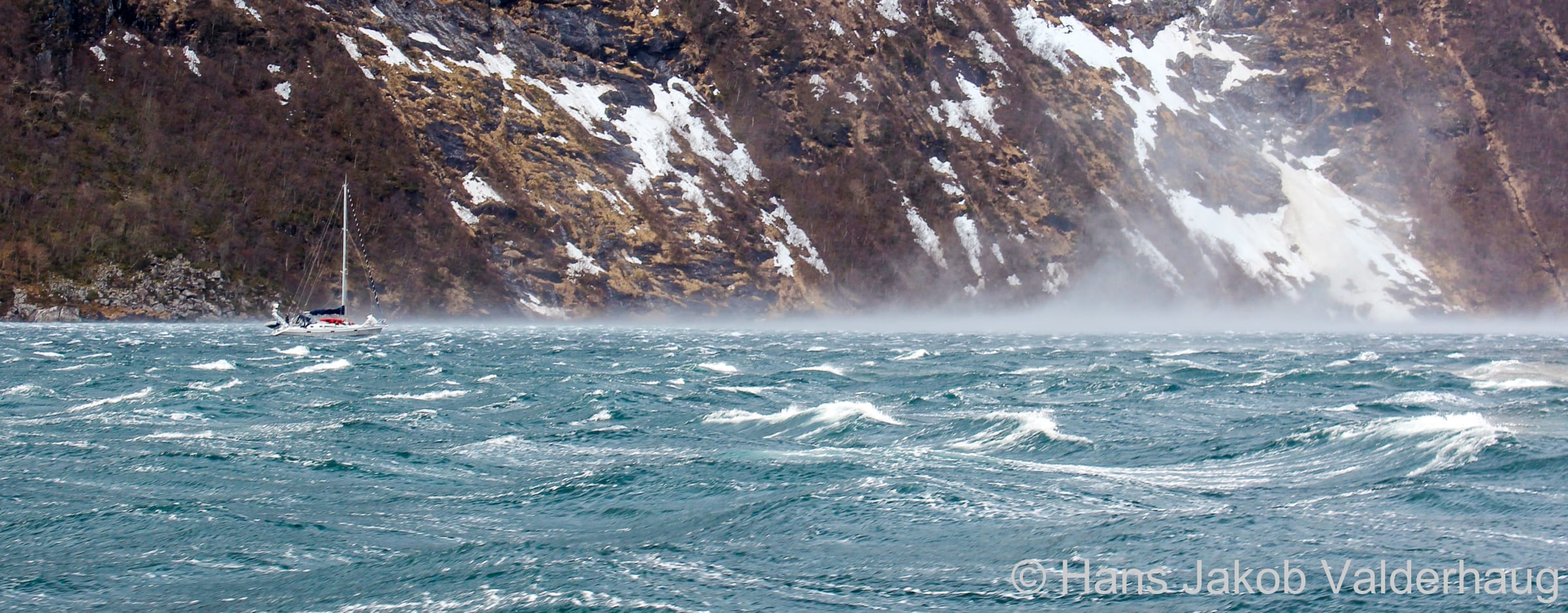
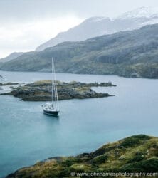
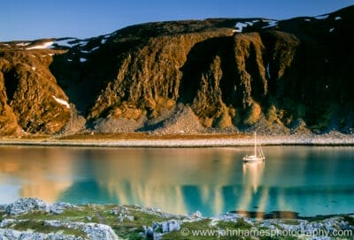
    The scenery in this area is grand, rugged and awe-inspiring. There are huge fjords, which run for up to 115 nm inland, with inhospitable shores, incredible depth of water, and almost vertical cliff walls rising 1000 m or more from the surface of the water. All this can cause squalls and unpredictable winds. 

    Here the skjærgård provides miles of protected waters but not necessarily good sailing breezes. Surprisingly, there may be less wind the further north you go, as the south is more on the main track for summer depressions. 

    Though this area is much less populated than southern Norway, there are still a number of small coastal cities and hundreds of tiny village harbours. The coast between Trondheim and Lofoten has become a popular destination for cruising sailors, but outside the larger centres you may still find yourself the only visiting boat in many places.

    Lofoten to the Russian Border (Volume 4)

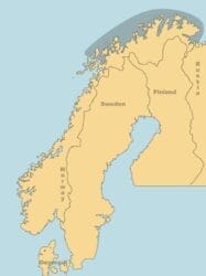
    The land is lower here than on the west coast but still indented with deep fjords. Most of the coast west of Nordkapp has offlying islands, though there are gaps in this protection. 

    Once east of Nordkapp, you are exposed to the Barents Sea, with only a few sheltered harbours. People are thin on the ground but the warm welcome you will receive as a visiting boat—an unusual event—will more than make up for any inconvenience or discomfort.

    At the Russian border you are as far north as parts of Greenland and further east than Istanbul. That’s out there!

    Sample Itineraries

    To cruise the whole coast of Norway in-depth would take a lifetime, and few of us have that luxury, other than Norwegian mariners. However, leaving your boat in Norway over one or more winters and returning to cruise in the summers is one way to get more exposure to this incredible and varied coast (make sure to research Customs and Immigration regulations prior to your voyage).

    Sailing distances between principle ports

    Below are a few possible cruises based on our experience and preferences (we tend to choose anchorages that have opportunities for hiking and/or skiing).

    Cruise #1 (Volumes 2 and 3)

    In order to experience some of the grandeur of the west coast as well as the good sailing of the south coast east of Lindesnes, we suggest the following:

    • Landfall at Tananger or Skudeneshavn.
    • Sail north to Bergen.
    • If you are interested in hiking, spend some time in Sognefjorden.
    • Sail south to Stavanger and, if you didn’t have time to visit Sognefjorden, explore Lysefjorden. (This is one of the most beautiful and spectacular fjords in Norway but with the great advantage of being only just over 20 nm long.)
    • Sail south around Lindesnes and then to Oslofjorden.

    Cruise #2 (Volumes 3 and 4)

    If you want to focus on the west coast and Lofoten, we suggest the following itinerary:

    • Landfall at Ålesund.
    • Sail north through the skjærgård.
    • Sail to an offshore island near the Arctic Circle, e.g. Myken or Træna.
    • Sail directly to Røst in Lofoten.
    • Circumnavigate Vestfjorden clockwise.
    • Explore Tysfjorden.
    • Return south along the mainland coast, with a stop at Trondheim.

    Cruise #3 (Volume 4)

    If you are fortunate enough to return for another season, or have enough time to continue on north of Lofoten, we suggest the following:

    • Explore Vesterålen (the island group north of Lofoten).
    • Continue north outside Senja and Kvaløya.
    • Sail to Tromsø and on to Honningsvåg, outside Sørøya if weather permits.
    • Continue on to Kirkenes.
    • Anchor in Lille Sandbukt in order to visit the Russian border.
    • Return south to Tromsø inside Sørøya, spending some time hiking in Lyngen.
    • Sail inshore via Finnsnes and Harstad and through Tjeldsundet to Vestfjorden.
  • Preparation

    Below is a short list of adaptations to your boat and preparation tips that will make your cruise of Norway more enjoyable.

    See the chapters on anchoring and docking (tying up), and electricity and cooking gas for more preparation tips.

    Spare Parts

    List of boatyards and boat storage facilities

    Though maintenance facilities for sailboats are limited, particularly in the north, there are fishing boat facilities everywhere that can be utilized for repairs with a little bit of ingenuity, if you are carrying a good selection of spare parts. Due to the cost of parts and shipping, we advise you stock up before leaving for Norway.

    Spare Parts—Which To Buy and How To Keep Track Of Them at Attainable Adventure Cruising

    Reliable Heater

    The night, and sometimes the day, can get quite chilly in north Norway, even in summer. At times the night can be chilly even in the south. A reliable heater will make your cruise that much more enjoyable.

    Articles on heating and ventilation at Attainable Adventure Cruising

    Reliable Engine

    A reliable engine is a must for north Norway, as steady sailing winds can be very elusive, and when traveling in the sheltered passages and fjords, what wind there is will often be funnelled directly from ahead or astern.

    Online Book: Engines For Cruising Boats at Attainable Adventure Cruising

    On-deck Navigation

    An on-deck chart table and/or plotter is invaluable for navigating the torturous, though well-buoyed, channels, especially if sailing shorthanded.

    Reliable Autopilot

    A reliable autopilot will give you and your crew a break from the monotony of steering when it is necessary to travel long days with the engine running. 

    Autopilot Buyer’s Guide at Attainable Adventure Cruising

    Redningsselskapet

    The Norwegian Society for Sea Rescue (NSSR) was founded in 1891 with a goal to save life and property at sea and to offer accident prevention guidelines and courses. The rescue vessel crews also perform other important but less critical tasks such as towing and assistance when in harbour in case of a mechanical breakdown.

    Unless you are a member, any towing or other rescue work that Redningsselskapet does for you will be at your cost. Joining after a rescue to avoid paying the towing bill is not an option, as one contributor found out to his dismay!

    As of spring 2024, Redningsselskapet will not be able to readily accept foreign payments as a new administration system requires the Norwegian BankID for registering new members. They are working to correct this and state that the problem should be sorted for the 2025 season. However, it does seem as if they have a work around, as we have heard of two foreign sailors who have been accepted, so it is worth a try (see contact information below).

    If Redningsselskapet will not accept your application for membership we suggest you consider becoming a member of the Swedish sister organization Svenska Sjöräddningsselskapet. There is an agreement between Scandinavian sea rescue organizations so that membership in Svenska Sjöräddningsselskapet will cover comparable assistance provided by Redningsselskapet.

  • Rules and Regulations

    Procedures for border crossings are covered by EU/EEA, Schengen, and national regulations, which has resulted in a complex situation that can be difficult even for those in authority to totally understand. 

    Also, the regulations that apply to visitors (Immigration) and those that apply to visiting boats (Customs) are very different, and this can cause confusion for visiting mariners who don’t understand that there are two sets of regulations in force.

    If you are not a citizen of an EU or Schengen country, we recommend that you consult your Norwegian Consulate to get information on the laws in force at the time you are planning to leave for Norway.

    Customs

    Customs regulations state that owners of pleasure craft do not need to present to Customs upon landing in Norway; however, we advise that you log the day of your arrival.

    An exception is if you are carrying goods that need to be declared, including alcohol and tobacco greater than the quota allowed (the quotas are extremely limited and enforcement is strict). There is a Customs app where you can check the quotas allowed and even pay any duties owed.

    Value Added Tax (VAT)

    Upon leaving Norway you can apply to have VAT refunded for parts imported or purchased while in Norway, but this must be done in person at a Customs office.

    Norway is not a member of the EU, hence a foreign boat, even if previously imported to another European country, is subject to Norwegian VAT. At present this is 25% of the boat’s value and technically may be charged if the boat is left behind in Norway for longer than 6 weeks. 

    However, Customs has the power to allow a vessel to be stored in Norway for up to 24 months before it becomes eligible for VAT. Boat owners must apply for permission to leave their boat prior to leaving the vessel. At the end of the first year, boat owners can apply for permission to leave their boat in Norway for a second year.

    If you plan to spend more than 6 months in one year away from home, even if you only spend part of that time in Norway, there may be VAT and other issues (i.e. it could cost you if you are deemed resident in Norway because you are deemed to not be resident in your home country).

    Immigration

    Norway has been a signatory to the Schengen Agreement since 2001. Most European countries are part of Schengen, including Denmark, Finland, Norway, and Sweden, but not the UK or the Republic of Ireland.

    Svalbard is not included in the Schengen protocol. 

    Norway is one of only four Schengen countries that are not also members of the EU.

    If you are a citizen of a non-Schengen country, you are required to get a visa for travel in the Schengen countries prior to entry. There is a list of countries exempt from this visa requirement and, at the time of writing, the US, Canada, and the UK are exempt, among others.

    The basic concept behind Schengen is that once you have formally cleared into one of the Schengen countries, you can then travel freely without having to clear into each country individually, for a total of 90 days in any 180-day period, after which you must leave the Schengen area. An online calculator is provided so you can determine when you are allowed to re-enter Schengen. (When tested for a citizen of Canada, the time until re-entry was around 3 months.)

    A foreign boat entering Norwegian waters from offshore is formally crossing a Schengen outer border; therefore, you should plan to make landfall at an official Port of Entry. While boats registered in a Schengen country are generally not expected to register with the authorities, we suggest you plan landfall at an official Port of Entry and enquire.

    We identify Ports of Entry on the map at the beginning of each Harbours and Anchorages chapter. There is also a list of Ports of Entry here, though it is out of date (Ports of Entry are listed in the far right column; the middle column is a list of Border Crossing Stations). Note that Immigration officers are only found at Border Crossing Stations; police officers fulfill that function at Ports of Entry.

    All those entering Norway by boat are technically required to report to SafeSeaNet Norway 24 hours in advance of landfall, who will then contact the appropriate officials. But, in order to report, you must have an online account set up (which should be done prior to leaving for Norway) and have internet access (it appears at the time of writing that you may also need an agent). Of course, this may not be feasible, in which case, if you have cell phone coverage, you should contact the police regarding your intended landfall (Tel.: 02800).

    If neither of the above options are possible, you should contact the authorities immediately upon landfall and enquire about formalities (Tel: 02800). The response seems to vary between regions. In some cases sailors have been asked to report to the nearest border crossing station when that is feasible, others have been asked to report to the local police station, and some have had a police patrol visit the boat. 

    Special regulations apply to boats larger than 24 m in length or 50 gross tonnes in weight and State Vessels. Many large sailing instruction vessels have this later designation and this seems to trigger a more cautious approach from the authorities.

    Norway has signed on to two new programs which will affect travellers to Europe.

    • Entry and Exit System (EES):
      • an automated system for registering non-EU nationals travelling for a short stay, each time they cross the external borders of a European country
      • implementation scheduled for sometime in 2025
      • once implemented it will no longer be possible to have passports stamped by the police and you will have to seek out an official border crossing, most likely an airport, with the appropriate equipment
      • we have made enquiries to the Police and the Norwegian Coastal Administration and will update this information once we hear
    • European Travel Information and Authorization System (ETIAS):
      • those non-EU citizens who don’t require a visa will need to get a travel authorization linked to their passport
      • implementation date unknown

    Extending Your Stay

    Non-EU Citizens

    Non-EU citizens are not allowed to extend beyond the 90 days in a 180-day period allowed under Schengen rules.

    However, a possible exemption may be made for sailors wintering their boats in Norway (see above under Value Added Tax). On the Norwegian Directorate of Immigration Seafarers page, there is a section titled “Spending the winter on a boat in a Norwegian port”. The requirements are listed there and a link to apply.

    We have not heard from anyone allowed a longer stay in Norway using this legislation. Please tell us if you have further knowledge.

    EU Citizens

    EU citizens who wish to stay in Norway for longer than 90 days are required to make a formal application, which can be completed online

    Coastguard

    Certificate of Competency

    Norwegian skippers (born after 1980) of boats between 8 and 15 m in length are required to hold a Boating License. If the boat is between 15 and 24 m in length, Norwegian skippers are required to hold a Deck Officer Class 5 Pleasure Craft certificate. An alternative to this is an International Certificate of Competency (ICC).

    For skippers of foreign boats, we are informed that the Norwegian Coastguard will follow the regulations of the country where the boat is registered (the flag-state principle).

    A visitor wishing to charter a Norwegian boat must produce evidence of a comparable Certificate of Competency (in English or a Scandinavian language) to those discussed above, depending on the size of boat being chartered. 

    Drones

    We realize that getting an aerial shot of your boat in a harbour or anchorage is awesome, but do be aware that every visiting mariner is thinking the same thing. Which means that in popular harbours such as Henningsvær in Lofoten, there is hardly a day in the summer that some visitor isn’t flying a drone above the town. If we want to be welcomed by local residents, we need to be sensitive to the impact our presence and activities have on them.

    It is usually necessary to register and pass an exam in order to fly a drone in Norway, even recreationally. Only drones weighing < 250 gms without the camera, and drones CE-marked as toys, are exempted. In surprisingly large areas of the country, flying drones is not allowed without a special permit. Details can be found in the Ninox Drone app.

  • Navigation

    Online Book: Navigation and Marine Electronics at Attainable Adventure Cruising

    Charts and Publications

    Nautisk Fritid sells marine charts and publications online and in their Oslo store.

    Norwegian Government Charts (Kartverket)

    The entire Norwegian coast has been re-surveyed to WGS-84 datum as of 2007.

    Two Kartverket documents that may be helpful:

    Paper

    Available only as print-on-demand (POD), although some bookstores may still carry some local charts.

    List of suppliers

    Online

    Kartverket provides their charts integrated with pilot information (Den Norske Los) online.

    See the latest chart updates at Notices to Mariners (Etterretninger for sjøfarende – Efs).

    Other Charts

    Paper

    Båtsportkart (Nordeca)

    In groups of charts from the Swedish border to Rørvik.

    • Based on a scale of 1:50,000
      • Not good for forward planning
      • Small size may be useful on small boat
      • Best if cruising in a small area
    • Include information about nature reserves, toilet facilities, etc.
    • In Norwegian only
    NV Verlag Atlas

    In groups of charts from the Swedish border to Haugesund.

    • Introduction in English and Norwegian
    • Include tide data
    • App included

    Electronic

    There are a number of companies offering electronic charts for Norway.

    Sailing Directions

    Den Norske Los (The Norwegian Sailing Directions) is no longer available in print but is being integrated into Kartverket online marine charts.

    The volumes are also available as PDF downloads; however, they have not been updated since 2018. The text is in Norwegian only, with the exception of Vol. 7 (Svalbard and Jan Mayen), but there are numerous sketch maps and aerial photos in the PDFs that may be helpful.

    Other Cruising Guides

    Havneguiden

    Though the text is in Norwegian, with a short summary in English, the aerial photographs and charts may be useful for pilotage. They have an app through which you can purchase the online equivalent to their printed books. 

    Velihavn

    Compiled and updated by Redningsselskapet (The Norwegian Society for Sea Rescue), this website covers harbours along the mainland Norwegian coast. In Norwegian only.

    Norskehavneguide/Harbourmaps

    An online crowd-sourced map-based guide to harbours all over the world, in Swedish, Danish, Norwegian and English.

    Aids to Navigation

    There are 13,400 (give or take one or two!) aids to navigation along the coast of Norway; some are single isolated beacons and some are clustered thickly. The skill of their placement makes navigation of even the narrowest and most complex channels relatively easy.

    On Norwegian charts, green buoys have their outline filled in while red ones have the inside of the symbol left blank and so are easy to overlook. For more on navigation symbols, see Symbols and Abbreviations on Maritime Charts (in English and Norwegian)

    Many channels, such as Blindleia in south Norway (Volume 2) and the approaches to Veiholmen on Smøla (above picture), are positively alarming when first looked at on the chart due to the intricacy of navigation required, but you will find them perfectly easy to follow in practice, since every point of difficulty has an aid to point the way.

    Buoys

    Norway complies with the I.A.L.A. A buoyage system, as used in the rest of Europe. When following the direction of buoyage inbound to a harbour, green buoys will be to starboard and red buoys will be to port. 

    The direction of buoyage originates at Norway’s southmost point, Lindesnes, and proceeds in two paths:

    • One path follows the coast to the west, then north, then east around Nordkapp and then south to the Russian border.
    • The other path follows the coast to the east and then northeast, then splits north towards Oslo and south towards the Swedish border.

    In interior leads and fjords, the direction of buoyage is inwards from the sea, independent of the compass direction. Around islands there may be confusion regarding the direction of buoyage and you will need to consult the chart for clarification. 

    Black/yellow directional (N, E, S, W) cardinal buoys are used, often without double triangle top marks or lights.

    Varder (singular varde)

    Varder are stone towers painted black, often with some form of white stripe, which makes them individually recognizable. 

    They make up the world’s oldest system of navigational aids still in use and are denoted on Norwegian charts with a 4-pointed star and a V. They may be lighted.

    Varder often carry top marks consisting of a short post supporting a single horizontal arm, in which case the varde should be passed on the side towards which the arm is pointing; however, do not blindly follow the pointer without identifying the varde on the chart and checking the depths shown. 

    Other varder may be passed on either side and these are used as landmarks, progress marks or leading marks.

    Båker (singular båke)

    A common type of beacon, båker are of no unique shape but most often are a tripod or latticework structure shaped much like a varde. They are denoted on Norwegian charts with the same 4-pointed star as varder but they are marked with a B rather than a V.

    Perches

    A jernstang (steel pipe) usually imbedded in a rock, perches are used in the same way as varder and båker but at a more local level. Numerous perches may be used to mark a channel through a group of rocks or an offshore shoal may be marked on more than one side by perches with outward-facing top marks. Again, it is important to clearly identify the perch on the chart and determine which side to pass on; don’t just blindly follow a pointer. 

    Perches are clearly marked on Norwegian charts but are often visible only at relatively short range, and sometimes they only project a short distance above the surface at high water, so it is necessary to keep a sharp lookout. It would be a pity to hit a perch marking a rock over which you could have passed safely! 

    Many have reflecting strips, sometimes red or green; the colour is not necessarily consistent with the buoyage colour scheme, so do not depend on the colour to indicate on which side to pass.

    Sector Lights

    Strategically placed in the skjærgård, enabling very accurate navigation in these intricate waters during the winter dark, in daylight the distinctive little cylindrical white houses with red roofs remain useful reference points for pilotage.

    Lighthouses

    All lighthouses in Norway are automated.

    HIBs (hurtigbåt indirekte belysning/high-speed indirect light)

    Express boats move at speeds where navigating using ordinary sector lights becomes difficult. With this in mind the Coastal Authority has developed a new type of navigation mark, using solar panels, lithium batteries and LED technology to power a fixed light that illuminates a fibreglass structure. The markers are numbered and usually carry a red or green stripe. It is expected that over the years HIBs and mini-HIBs (used in passages frequented by recreational vessels) will replace many of the existing navigation markers. So far they are mostly found on the south coast, but their “test bed” was Spitsbergen. 

    Regulations

    Although Norwegian coastal traffic is generally alert and courteous, occasionally ships fail to give way to pleasure boats, or pass disturbingly close at high speed, in seeming contradiction to the courtesy and high level of seamanship you usually find here. This may be caused by factors unlikely to be known to a foreign pleasure boat skipper as it is based on differences between the Norwegian Rules for Navigation in Inland Waters and the International Regulations for Preventing Collisions at Sea (also known as COLREGS).

    According to the Norwegian rules, vessels under 20 m in length and all sailing vessels must keep clear of engine-driven boats which are following the channel in traffic separation zones.

    Further, it also states that pleasure boats and open or sailing craft are required to keep clear of larger ships, ferries en route, and other commercial vessels when in narrow routes, in crowded or busy channels, and in harbour areas. This causes problems, even between Norwegian pleasure craft and ships, since what is considered narrow or crowded is subject to interpretation and harbour boundaries can extend miles from the inner harbour. 

    What causes even more confusion is that there is a widespread belief—partly fostered by errors in the national boating literature—that this second rule applies to all coastal waters.

    Awareness of this situation may help foreign pleasure boat skippers avoid unpleasantly close encounters and help them to understand what seems like boorish behaviour on the part of ship captains. In Sweden the saying is: “Those who sail for their leisure should yield to those who sail for their bread and butter…”

    Challenges

    Coastal Danger Areas

    There are sheltered inshore passages behind the skjærgård (off-lying islands) for most of the coast between the Swedish border and Lindesnes (Volume 2) and then again for the long distance from Tananger to Nordkapp (Volumes 2, 3 and 4); so even when it’s quite windy you can sail in smooth sheltered waters most of the time.

    However, there are places where there are gaps in these protecting islands and, when these gaps coincide with a coastal danger area, you will need to take special care. Den Norske Los, Vol. 1, lists 24 areas of the coast likely to have exceptionally high, steep or chaotic seas under certain conditions of wind and tidal stream. In these places bottom contours (even when at substantial depth), coastal topography, and currents interact to produce sea-state conditions that can be much more severe than would normally be expected for a given wind speed.

    Coastal Danger Areas are shown on the map at the beginning of each Harbours and Anchorages chapter

    Tides, Tidal Streams and Currents

    More detail is given about tides, streams and currents at the beginning of each Harbours and Anchorages chapter

    In Norwegian, a tidal stream is shown by –straumen or –strømmen at the end of a name (e.g. Saltstraumen and Brevikstrømmen), and –renna refers to a narrow passage (e.g. Risøyrenna), which may or may not have a strong tidal stream.

    Tides

    Kartverket provides online tide information

    There is a progressively greater rise and fall of the tide as you travel north, with a spring range of around:

    • 0.6 m at Stavanger
    • 1.2 m at Bergen
    • as much as 3.7 m at the Russian border

    High water in Bergen is approximately 1 hour before high water in Dover.

    Tidal Streams

    The Norwegian Coastal Administration (NCA) has developed a wave and current forecast for fairways

    There are no significant tidal streams east of Lindesnes though strong currents may be found at the mouth of large rivers such as Skjenselva and Drammenselva (5 knots is not uncommon).

    West of Lindesnes there is considerable tidal stream in some of the inshore channels and in some of the fjords, due to river flow, wind and other factors, requiring transit planning.

    Currents

    On the southeast Norwegian coast there is a generally southwest-going current with maximum strength at about three to ten miles offshore. Strong winds may have an affect on the current, even to the point of reversing the direction. The current may also be reversed inside the islands in places.

    West of Lindesnes the current sweeps round the coast and up to the north, though strong winds may have an effect, even to the point of reversing the direction.

    Overhead Cables and Bridges

    Overhead power cables are common in Norway. They are marked on the charts by a red broken line, with the lowest height in metres shown in red. These markings are usually conspicuous, but they can be missed where they are printed over numerous islands or other features. It is also possible that a new cable has been added since the printing of the chart, so it is important to keep a sharp lookout for them. There is usually a sign posted on the shore near the cable showing height in metres, but the height shown on the sign and that printed on the chart are not always in agreement.

    Bridge height in metres at high water is shown on charts as Bru(15). Note that there are new bridges being built all the time due to Norway’s commitment to providing infrastructure to outlying areas.

    For up-to-date information consult Kartverket’s online charts

    Fish Farms and Fishing Gear

    Not all of the many fish farms in Norway are shown on the charts, as their positions often change, so it is important to keep an eye out for them. Another thing to be aware of is that mooring ropes have been known to run between the surface buoys and the shore with nothing to alert the mariner to their presence. Sailors from Tromsø ran into just such a situation and ended up with the mooring rope caught between the rudder and the prop.

    October 1 marks the start of the lobster season in Norway. The buoys are small, usually without flags, and difficult to see even in daylight in a flat calm. These pose a risk for the late-season cruiser making an inshore passage.

    Restricted Military Areas

    There are a few small military areas indicated on the chart, some of which may not be entered, and some of which may be transited without anchoring, fishing, or diving. Note that special requirements apply to boats greater than 50 tonnes or 24 m in these areas.

    Magnetic Variation

    The magnetic variation is small enough on the northwest Norwegian coast to ignore for most coastal navigation; however, on the southwest Norwegian coast the variation reaches around 5°W and, as you sail east from Nordkapp towards the Russian border, it increases to around 12°E.

    Compass Dip

    Above 60°N a handheld compass might suffer from some dipping, making it sluggish, but it should still be usable. If your boat is from the southern hemisphere, make sure you have your steering compass changed over to a northern hemisphere-balanced card. Generally, fluxgate compasses are fine. 

    Darkness

    The inshore passages and most harbour approaches are exceptionally well lighted in Norway, so inshore navigation at night is certainly possible; however, in summer the hours of darkness are few or nonexistent, so most visiting cruisers will have no need to be underway inshore in the dark. 

    Sunrise and sunset times

  • Communications

    VHF

    Almost the entire mainland coast has comprehensive and clear VHF coverage. The rare exceptions are areas deep within fjords with high shores. Since most of the shore station VHF aerials are situated on high mountains, the coverage extends surprisingly far offshore. 

    There is very little traffic on channel 16 in Norwegian waters so it isn’t onerous—and it is required—to keep a listening watch for weather and navigation warnings.

    In Norway, unlike many countries, initial contact should be made on the correct working channel for your location. If, after trying a couple of times, you can’t make contact on the working channel, call on channel 16, but be sure to give details of your position so the operator can select the correct relay station. After initial contact on 16 you will be directed to a working channel.

    Coast Radio Contact Information

    Coast radio stations can be used to make VHF-to-telephone link calls; however, this is expensive and a mobile phone (see below) will be a cheaper and easier option, albeit with shorter range. If you do wish to use this VHF service you will need to establish an account with an accounting authority, preferably before leaving your home country. Contact your country’s communications authority for a list of approved accounting authorities.

    Norwegian coast stations are fully DSC (Digital Selective Calling) equipped and you can even make a telephone patch call with DSC.

    Even if you don’t intend to use DSC, make sure you have a MMSI number (available from your local communications authority).

    All services provided by a coast radio station, including providing a requested weather forecast, will be charged to the vessel. This may be waived if fulfilling your request is not too onerous and it doesn’t happen too often.

    Coast Radio has been consolidated into two main stations, with numerous automated relay stations:

    • Norwegian Coast Radio South covers from the Swedish border to Rørvik (65°N) (Volumes 2 and 3)
    • Norwegian Coast Radio North covers from Rørvik (65°N) to the Russian border and also covers parts of the Barents Sea through relay stations on Bear Island and Spitsbergen (Volumes 3, 4 and 5)

    The two coast radio stations are located in the same premises as the two Joint Rescue Coordination Centres, JRCC South Norway and JRCC North Norway.

    Single Side Band Radio (SSB)

    Medium frequency service (MF) is available from Norwegian coast radio stations. High frequency service (HF) has been discontinued for mainland Norway. 

    Because of the range and coverage of VHF, there is no reason to use SSB when cruising mainland Norway.

    Mobile (Cell) Phones

    Norway is part of the “roam like home” network for residents of Europe.

    Options for non-European cruisers:

    • Use your own phone with your regular plan, but make sure you check with your provider for their international roaming and data roaming charges.
    • Purchase a SIM or eSIM for use in Norway, with your own phone if your provider will unlock it, or with a new phone. There are numerous options, so we recommend you do your research prior to leaving for Norway.

    Important numbers:

    • Fire 110
    • Police 112
    • Medical emergency 113
    • Rescue Centre South +(47) 51 69 00 44
    • Rescue Centre North +(47) 75 52 89 25
    • Emergency call to nearest coast radio station 120

    Satellite Phones

    Due to the excellent mobile phone coverage found in mainland Norway, a satellite phone is not required for voice or data.

  • Weather and Weather Forecasts

    Conditions

    Winds 

    • The solgangsbris (afternoon sea breeze) in south Norway makes for more reliable sailing conditions than in the north. 
    • The fjords and high cliffs of the west and north coasts can cause immense gusting and funnelling, making local effects of more interest to the mariner than the weather forecast. It is best to motor or motorsail well reefed down in these conditions. When anchoring it is important to assess the topography’s potential to generate strong gusting (fallvinder).  

    Temperature

    The temperature can change drastically from year to year as we found in our two years in Norway. Our first summer was rainy and cold while the second summer was warm and sunny. (Unfortunately, we were in Svalbard for much of the sunny summer, where it was—you guessed it—rainy and cold!) 

    Based on the variability of the weather, we suggest that you bring a wide range of clothing, from T-shirts to heavy-duty long underwear, and make sure to have good quality foul weather gear, gloves, hats and boots.

    Forecasts

    Online Book: Weather Reception and Analysis at Attainable Adventure Cruising

    Weather forecasting in Norway is challenging due to the complexity of the weather systems, which are often fully occluded and spawning secondary low pressure systems by the time they reach Norwegian waters. In addition, local weather may be greatly influenced by terrain, with substantial changes in wind direction, precipitation and visibility.

    However, despite these local variations and the fact that violent weather is unusual in the summer, it is still important to keep up to date with the weather situation.

    Because of the Coastal Danger Areas and the small size of Norwegian motor and inshore fishing boats, gale warnings are issued for Beaufort Force 7. Get caught off Stattlandet in that much wind and you’ll understand why! The Beaufort Wind Scale in Norwegian

    VHF

    Norwegian coast radio stations broadcast navigation warnings, including gale warnings, as part of their Marine Safety Information Broadcasts. A short message is given on channel 16 and the full warning is given shortly after on the working channels. 

    A local forecast is broadcast in Norwegian at 0900, 1200, 1500, 1800 and 2100 local time on the relevant working channel.

    Navtex

    There are Navtex stations at Svalbard (A), Bodø (B), Vardø (C), Rogaland (L), Jeløy (M), and Ørlandet (N), all transmitting a 24-hour forecast on 518 KHz 6 times daily in English. As of yet, there is no transmission on 490 KHz from Norway, Sweden or Denmark.

    Internet

    The Norwegian Met Office

    Their online weather forecast (scroll down to choose language) is a fabulous resource for both land and sea. You can access the forecast for a sea area by going to the map and clicking on the sea area you are interested in.

    New for 2024 is a 21-day forecast for precipitation, temperature and frost risk.

    They also offer text forecasts for land areas, coastal areas and sea areas (see below for a discussion of forecast areas).

    NRK Radio

    The shipping forecast is available online at NRK Radio (search on værmelding/weather forecast) and as a 24/7 recorded message on the NRK Radio app (see below for a discussion of forecast areas).

    GRIBs

    The Norwegian Met Office provides GRIBs based on their own models for the 3 days out. You can also access longer range GRIBs using a GRIB viewer such as Windy, PredictWind or LuckGrib, etc.

    Broadcast Radio

    Norwegian FM transmissions have been phased out and replaced by the DAB+ (digital audio broadcasting) network. 

    If you can decipher spoken Norwegian, forecasts can be found as follows (see below for a discussion of forecast areas):

    • The shipping forecast is broadcast on DAB+ radio at 0545 on ch P1+ (the “senior” channel).
    • P1+ also broadcasts 24-hour regional weather forecasts at approximately 2045. 
    • On DAB+ there is a continuous small craft weather forecast, which is updated 3 times daily, available as:
      • NRK-Yr region 1 & 2, Swedish border to Kragerø (NCG Volume 2)
      • NRK-Yr region 3, Agder and Rogaland (NCG Volume 2)
      • NRK-Yr region 4, Vestland (NCG Volumes 2 and 3)
      • NRK-Yr region 6, Møre og Romsdal and Trøndelag (NCG Volume 3)
      • NRK-Yr region 7, Nordland, Troms, Finnmark and Longyearbyen (NCG Volumes 4 and 5)

    BBC Radio 4 forecast is now only available at 0048 and 0520, and three times daily on weekends with an additional forecast at 1200. It is no longer on LW but on BBC sounds and FM, and UK coast radio stations when in reach.

    Forecast Areas

    Land and Coastal

    May use counties:

    • Though Nord Trøndelag and Sør Trøndelag are merged into one county called Trøndelag, weather forecasters may still use the former terminology, referring to the old division at Setervågen, S of Folda (NCG Volume 3)
    • Finnmark is often divided into east and west at Porsangerfjorden (NCG Volume 4)

    or regions:

    • ‘Østlandet’ covers the coast from the Swedish border to Kragerø (NCG Volume 2)
    • ‘Vestlandet sør for Stadt’ covers Rogaland and Vestland counties (NCG Volumes 2 and 3)
    • ‘Helgeland’ covers Nordland county south of Støtt (NCG Volume 3)
    • ‘Salten’ refers to the area between Støtt and Hamarøya (NCG Volume 4)
    • ‘Ofoten’ stretches from Nord Hamarøy to Tysfjorden, Hellemofjorden, and Ofotfjorden in to Narvik (NCG Volume 4)
    • ‘Lofoten’ and ‘Vesterålen’ are familiar terminology (NCG Volume 4)
    • and there are a lot of inland regions, which we have not defined

    Sea

    Based, sometimes rather loosely, on Norwegian Fishing Grounds areas. Be aware that some Norwegian areas that sound similar to those in the British shipping forecast actually cover different territory.

  • Stopping

    Anchoring

    If you are like us, you enjoy nothing better than a beautiful, wild and secluded anchorage, and in Norway, north Norway especially, there are an abundance of these; however, there are also challenges to anchoring in Norway. Below are some of the issues you may face.

    Online Book: Anchoring Made Easy at Attainable Adventure Cruising

    Sea Bottom Conditions

    There are various types of sea bottom in Norway that can make anchoring problematic, including thick kelp, stiff clay with weed, and hard sand. Having the right type of anchor (we find that the Spade works well in Norway), and knowing how to set it properly, will make anchoring enjoyable instead of a trial.

    Depth

    Norwegian anchorages tend to be deep, so carrying enough rode to anchor in 20 to 25 m of water (100 m or more of rode) will significantly increase the number of anchorages available to you. If that is not possible on your boat, then take as much as you can; preferably at least 60 m. 

    Limited, Sloping Shelf of Suitable Depth

    Often found in deep fjords, where depths shallow enough to anchor in are hard to find, the best approach in this situation is probably to drop one anchor as far inshore as possible, the extremely shallow depth compensating for the unfavourable downsloping angle of the bottom, and then to drop a second anchor in deep water offshore, the resulting short scope being compensated for by the favourable upsloping angle of the bottom.

    Small Anchorages

    Mooring bolts

    Many small anchorages have fortøyningsbolter (mooring bolts)—T-shaped metal pickets or rings set into the rock—often marked by target-like rings painted on the surface of the rock around them, without which they are very difficult to see.

    You will also see these in narrow channels; not, of course, for mooring, but as an aid to sailing vessels, prior to engines, to warp through.

    Some Norwegians, particularly those in smaller boats, carry their own mooring bolts, which they hammer into a crack in the rock.

    Shorelines (shorefasts)

    Shorefasts, Gear and Technique at Attainable Adventure Cruising

    It is customary in Norway to use an anchor off the stern or bow and a line to a mooring bolt, with the line led into the direction the wind is expected to come from. This can enable an anchorage to be used in heavy weather even when the holding is only moderate and also when the swinging room is limited (Scandinavian-style mooring). 

    One drawback of this method is that it takes considerable time and effort to rig and unrig shorelines. Also, side loading by wind on the beam produces very high stress on the anchor, which could potentially drag and, if the wind comes up from an unexpected direction or harder than anticipated, it could be very difficult to retrieve the shorelines and effect a change.

    On Morgan’s Cloud we sometimes use shorelines in very small anchorages; however, when swing room is limited but not very tight, we generally prefer to set two anchors 90° apart off the bow, their positions depending on the expected wind direction and bottom contour. This substantially reduces the swing room required and we find it easier than rigging shorelines.

    We suggest that you try both methods and see what works best for your boat and crew.

    Underwater Cables and Pipelines

    Chart symbols: a continuous wavy red line denotes underwater cables and a line of joined red dashes and spots, looking rather like a string of tadpoles, denotes underwater pipelines

    Challenges:

    • are not always shown on the chart, so keep a lookout on shore for signs that read Kabel or Avløp or Ankring Forbudt (Anchoring Forbidden); however, coves marked as anchorages on official charts with no submarine structures shown, that have been used by generations of mariners, are now marked with “no anchoring” signs, probably put up by residents of the many summer cabins (primarily in popular holiday destinations on the southeast coast)
    • the location shown on the chart does not always accord with reality (Hellemobotn in Tysfjorden, Vol. 4, being one example), so be very careful if trying to anchor near charted cables or pipes

    Shelter

    Anchoring in the lee of high steep ground will often be a poor choice due to fallvinder—extremely gusty winds peaking far in excess of the average; known elsewhere as williwaws or katabatic gusts.

    Tying Up

    Online Book: Coming Alongside (Docking) Made Easy at Attainable Adventure Cruising

    Visitors’ Berths (gjestebrygger)

    In larger towns and cities, and increasingly in smaller places, visitors’ berths are provided, frequently with some combination of electricity, water, showers and washing/drying machines.

    Many private boat clubs—båtlag and båtforening both mean boat club and would include both motorboats and sailboats, while seilforening refers to a sailboat club but would probably have a few motorboats as well—also have space designated for visitors and/or allow visitors to use members’ vacant spaces. 

    More and more harbours have installed floating pontoon systems (flytebrygger) with attached finger piers separating the berths. These are easy to tie to and convenient; however, since most Norwegians have smaller boats, anyone with a boat larger than approximately 12 m in length may find manoeuvring and berthing difficult in these small boat harbours (småbåthavner).

    Private Docks

    In places where there is no gjestebrygge or it is full, do not tie up to a private dock or pontoon unless invited to do so by the owner, and never plug into someone’s private electricity outlet without having agreed on compensation for this. Visiting sailors have been known to abuse the use of private docks, which means that locals may be less than pleased to see the next visiting boat that pulls into the harbour. Where there are no visitors’ berths available, you should seek out the nearest anchorage and visit the village by dinghy.

    Docks/Quays/Wharfs (kaier)

    In places where there is no flytebrygge, where the pontoon is full of visiting boats, or where the pontoon is too small, you may have to rely on quays.

    Several issues to keep in mind:

    • Leave enough slack in your dock lines to account for the tidal range
    • Some commercial docks may not extend below the rub rail at low tide, and many have old tyres secured along them to act as fenders, meaning the boat could drift under the tyres or the dock itself and then get caught on the rising tide. Several options:
      • keep the boat pulled off the dock using an anchor off the beam, if you can do so without hampering harbour activities
      • buy two large balloon fenders that slide over the tyres
      • go elsewhere

    Offshore Lines (lazy lines)

    In south Norway you may encounter fixed offshore lines consisting of one or two ropes per berth attached to a mooring offshore, run from there to the pontoon or wharf, and then allowed to sink to the bottom when not in use. These will be familiar to European mariners but may be a new experience for non-Europeans. 

    Technique:

    • back down to the pontoon
    • pick up a line with a boat hook without releasing it from the pontoon
    • walk forward overhauling the line
    • cleat it off at the bow
    • then cleat the same line aft with the appropriate amount of slack
    • if you prefer to approach bow in, just reverse everything

    This procedure is easy enough in calm weather but potentially exciting with a strong cross wind. In windy conditions it is important to get the line fastened on a forward cleat before the bow blows off, potentially swinging the stern toward the semi-submerged lazy line, with the potential to wrap it around the prop. 

    The fun of this whole procedure is enhanced by the fact that the line is usually filthy with mud and weed. 

    Fees

    Costs for dockage generally run between 200 and 400kr/24hrs and in most places there will be an extra charge for electricity, showers, toilets, and laundry.

    Methods of payment:

    • Cash: In some harbours you can pay at a shop or there will be a posted telephone number and you can enquire about paying in cash. Note that some harbours will charge you extra if you insist on paying with cash. In Tromsø this will easily double your berthing fees.
    • Bank transfer: A few harbours post their bank details allowing for a bank transfer.
    • Mobile pay: Many small harbours will only accept payment by VIPPS, which is a national mobile pay system widely used in Norway, limited to residents. The only option then is to liaise with a local who will pay your fees with their VIPPS account, making sure the owner gives your boat’s name in the payment details. Then you can pay the account holder with cash. 
    • Parking-meter style: Though some cruisers have experienced problems with US and Canadian cards in these machines, one American contributor who has cruised extensively in Norway reports that while credit cards “may” work, debit cards “always” work.
    • Apps: E.G. GoMarina or Mooringo, which seem to accept most debit cards.
    • Apple Pay: Though not used by many harbours yet, it is widely accepted in restaurants and shops.

    Webcams – get a look at harbours throughout Norway

    Moorings

    Local boating clubs have for many years put down moorings for use by their members. Recently, there has been a move by various agencies to install moorings that are available for all to use for 24 hours at a time. The usual warnings apply when picking up a mooring that you are unfamiliar with. 

    Most of the moorings available for general use will be put down by one of the following parties: 

    • Kystverket (The Norwegian Coastal Administration) has some moorings intended for fisherfolk waiting out poor weather. These will usually be located in areas less frequented by visiting mariners. While fishing boats have priority, the moorings are often vacant during the summer.
    • Kongelig Norsk Båtforbund (The Royal Norwegian Boating Union), for some years put down moorings from Stavanger to the Russian border. The project ran out of funding in 2022 and many of the moorings have been removed. In some locations local boatclubs have taken on responsibility for maintenance of the moorings, but in other locations the moorings have been left in place with no maintenance routine. We recommend you do not trust these moorings. 
    • Oslofjorden Friluftsråd has placed moorings in approximately 50 locations in Oslofjorden. The moorings are intended for boats up to 8 tonnes. Boats flying the Oslofjorden Friluftsråd burgee have priority.
  • Electricity, Fuel and Cooking Gas

    Electricity

    A long lead will come in handy to access centrally-located electrical panels

    In Norway, as in the UK and Europe, electric power is 220 volt, 50 cycle. Sockets seem to come in three types:

    • UK/European-style 16-amp three-pin outdoor and marine plug—most common.
    • Round two-pin European-style household-type plug—less common as being replaced with the three-pin 16-amp plug.
    • Larger UK/European-style 32-amp three-pin outdoor and marine plug—very rare.

    If you come across one of the increasingly rare two-pin plugs on a dock,  be aware that there is no way to determine correct polarity—a very dangerous situation for a boat with a grounded neutral wire, as many North American boats are. 

    We have also been informed by one contributor that the ground (earth) wire is often not connected to a true ground (earth) even when a three-pin socket is present and that the neutral may be floating above ground (earth) potential too. If that is true, plugging in could make every piece of metal on your boat live.

    Whatever the facts, we are dealing with 220 volts around salt water, a potentially killing combination. Of course, the best defense against electrocution is a properly-installed isolation transformer (see below).

    Making your shore power system safer at Attainable Adventure Cruising

    110-Volt Boats

    Shore Power

    If your boat runs on 110 volts, you will need an adaptor. We fashioned a pig tail with a North American female marine plug on one end, to fit into the North American male marine plug on our shore power lead, and a European male marine plug on the other end. We also made up a 30-m extension cord with a European female marine plug on one end and a two-pin male plug on the other end. Armed with this lot, which we easily made up with parts available from an electrical supply store, we could plug into just about anything.

    Ship’s Power

    North American boats will also need to fit a transformer to convert from 220-volt shore power to 110-volt ship’s power. While you are at it, you might as well make it an isolation transformer, which has the added benefit of increasing safety and reducing the chances of galvanic corrosion. 

    A transformer will allow a North American boat to run many 220-volt appliances, but remember that it won’t change the frequency, meaning that any equipment with a motor that is not made to handle 50 cycles will overheat.

    MasterVolt SoftStart damps down the initial surge that can blow the dock breaker when a transformer-equipped boat switches on.

    Fuel

    Diesel

    Diesel for boats is exempt from the road tax applied to diesel for automobiles and a green dye is added to differentiate it; but with all the other taxes added to the cost (C02, NOX, mineral oil…) it is no longer that much cheaper than ordinary road-taxed diesel.

    As of October 1, 2023, diesel sold to the marine market will have 6 to 7% biofuel (FAME) added. HVO (Hydrotreated Vegetable Oil) is available at a few locations on the southeast coast.

    Many marine diesel fuel points (on wharves, pontoons, in marinas) are unattended and have a credit card-activated fuel pump. Though some of these credit card machines don’t take foreign credit cards, this is changing rapidly throughout Norway and most now do. 

    Larger harbours will usually have a bunkering facility for ships and will often have a pontoon as well for smaller boats. If there is no pontoon, it will probably be necessary to fuel at high water in order to deal with the large quay. 

    Another option is to have fuel delivered by truck, but often these trucks only have large nozzles and don’t like to deal in small amounts of fuel. 

    The motto here is never miss an opportunity to fuel when it’s relatively easy!

    Petrol/Gasoline

    Petrol is readily available in the summer season on the south coast where large outboard engines are the norm. For the rest of the coast, you must be prepared to carry jerry cans from the nearest petrol station.

    Cooking Gas

    Propane (liquefied petroleum gas—LPG)

    Unfortunately, there has been little standardization of gas cylinders and regulators between Scandinavia, Europe, and North America or even, for that matter, among the Scandinavian countries.

    Photos of Norwegian cylinder and regulator types

    There are two large suppliers of propane to the Norwegian market: AGA and Nippon. These companies only deal with standard cylinders and the consumer market is served on an exchange basis. The cylinders are then refilled in large automated plants. They will not accept foreign cylinders. 

    However, LPG Norge has developed a chain of propane filling stations for automobiles where you can get some foreign propane bottles filled, including Camping Gaz. Because the emphasis has been on propane for automobiles, the locations of the filling stations are not always that handy for boats. Although they claim to have adaptors to fit most cylinders, it would be worthwhile carrying an adaptor which you know will fit your cylinder.

    Map of LPG Norge filling stations

    Another facility that may fill foreign propane tanks is VestGass at Straumane, north of Bergen.

    However, though the situation is changing, it is still not possible to fill foreign cylinders in most places in Norway, so there are several ways to get around the problem:

    • You can carry enough propane to last the time you will be in Norway. 
    • You can purchase a Norwegian industrial-type bottle and use it directly on a North American system. We understand this will work and that the threads are the same but we have not tried it. Make sure you carefully leak test this solution. Unfortunately, you can’t sell the bottle back when leaving Norway.
    • You can build a short hose with a Norwegian fitting on one end and a fitting for non-Norwegian bottles on the other, purchase a Norwegian bottle and use the hose to decant from the Norwegian bottle to the foreign bottle. This is a slow but, apparently, not a dangerous operation. (Note that we have never tried it and will not take any responsibility for injury to those who do!)
    • You can modify the boat’s system with a Norwegian regulator to use Norwegian bottles. Note that in Norway it seems common for the bottle attachment and regulator to be one unit, rather than separate and connected by a flexible hose as is common in North America. 

    Butane

    Butane (Campingaz®) is available in Norway only in small disposable canisters for camp cookers, grills, etc. We have heard that an adaptor to convert Campingaz® appliances to propane can be sourced in the UK from most Calor distributors but we highly recommend you discuss this with someone more knowledgeable on the subject than us. It may be best to carry enough butane to last the time you will be in Norway.

    Paraffin

    Paraffin used to be readily available on the Norwegian coast but is now harder to source after heating of homes with mineral oil was banned in 2020. Paraffin comes in varying degrees of refinement at extremely variable prices:

    • Paraffin used for domestic heating appliances may be available from pumps at some petrol stations in larger cities, and from Bunker Oil outlets along the coast—bring your own cans. This paraffin has a slightly pungent odour and is the cheapest option (other than jetfuel). 
    • Fritidsparafin has had some of the smellier substances removed and is available from petrol stations and chandleries in 2.5- or 4-litre jugs. 
    • Lampeparafin/Lampeolje has a waxing substance added and is primarily intended for wick-burning appliances. It will work in your burner but at the risk of premature clogging of the nozzle. It is expensive and usually only sold in 1-litre bottles. 
    • Jetfuel is available in Longyearbyen and on the mainland if you can get some from the owner of a light sport aircraft. It is cheap and will work in your burner. The smell is, however, rather off-putting. 

    Methylated Spirits

    In Norway, methylated spirits (denatured alcohol) is sold under the name rødsprit or, for a slightly less smelly alternative, as Fin Fyr. Although available all around the coast, dealers are subject to strict legislation concerning its storage, making it hard to source in some locations. In some towns (e.g. Bergen) it is most easily found in 1-litre bottles in shops selling paint. If you are doing all your cooking on methylated spirits it would be wise to stock up at a supplier offering 2.5- or 5-litre containers when you can find these.

  • Food, Alcohol and Water

    Food

    Provisioning

    The cost of groceries is high in Norway and so, if you are coming from another country where costs are lower, you may wish to stock up prior to leaving. 

    For topping up with fresh provisions once you are in Norway, you won’t have any problems getting what you need in the larger centres. Even most villages will have a small shop with a good supply of basic groceries.

    Hunting and Gathering

    If you like hunting and gathering you will have a great time in Norway since there are berries galore and the fishing is easy.

    Berries

    Blåbær (blueberries) are plentiful in August. 

    Multebær (cloudberries/bakeapples) look like pale orange raspberries and are a Norwegian delicacy that is also available in August. We suggest you do not pick multebær without asking; some patches are privately owned and we know of at least one area where u-pick fees may be charged.  

    Tyttebær (lingonberries/partridgeberries) are small cranberry-like berries that grow on shiny green leaves. They are plentiful in the fall.

    Fishing

    No license is required to fish in salt water for personal consumption, but there are a few things to know.

    It is possible for non-residents to obtain a freshwater fishing license.

    Alcohol

    Alcohol can be purchased from the government liquor store Vinmonopolet (to find a store, click on Butikker on the top menu).

    Norwegian law mandates that you are not allowed to handle a boat under 15 m LOA with a blood alcohol level greater than 0.08%. The limit for handling boats greater than 15 m LOA is 0.02%. While it is unlikely that you will be given a breathalyzer test while underway in a pleasure boat, the law is enforced and fines have been levied.

    Water

    Water is usually available on pontoons, quays and at fuel stations throughout Norway, and is potable. We do not recommend that you fill with water from streams or lakes as giardia and other parasites may be present in untreated water.

  • Environmental Concerns

    Environment Norway

    Rubbish

    Norway generally has little current or tidal stream to carry away rubbish thrown over the side. Consequently the skjærgård would quickly be ruined were it not for the very high level of discipline displayed by users of these waters, which are spotlessly clean as are almost all harbours and quays. Please do your part to keep them that way. 

    There are large containers for rubbish in almost all harbours and, if you are spending a few days in an anchorage, you should take your rubbish on to the next harbour.

    It is against the law to throw refuse overboard within the skjærgård.

    Holding Tanks

    The EU and affiliated countries have agreed to a treaty prohibiting any release of black water overboard, known as the Helcom Convention. This agreement has been implemented in all the Nordic countries except Norway. 

    In Norway there is no formal regulation requiring foreign-flagged vessels to have holding tanks installed; however, Norwegian law states that the discharge of sanitation devices is not allowed within 300 m of shore.  

    There are, however, some harbours in south Norway that are zero-discharge zones and this rule should be followed in any small anchorage or harbour that doesn’t flush well.

    In the Oslofjord (defined as the area from the Swedish border to Kragerø, including all of the fjord in between), legislation was introduced in 2024 making it illegal to empty black water overboard. A list of pump-out stations can be found here.

    There are virtually no pump out facilities in north Norway and they are few and far between even in south Norway.

    Many of the anchorages described in the Guide have basic toilet facilities ashore and we encourage the use of these whenever possible; however, at sea, even in fairly confined areas, there is no restriction on using marine heads. 

    Wildlife

    Norwegian wildlife names

    Annoying or Dangerous

    • Mosquitoes and flies can be a problem to the sensitive and in some places appear to grow to the size of sparrows!
    • Norway does have ticks, leading to concerns re Lyme Disease and encephalitis.
    • The only poisonous creature in Norway is the Black Adder.
    • Moose (elg) should be avoided during the fall rutting season. 

    Seabirds

    Norway is a country of seabirds, with several coastal islands internationally known for large colonies: Runde near Ålesund, Røst in Lofoten, Fuglnyken and Bleiksøya in Vesterålen, and Fugløya near Torsvåg. The area around Bodø is heavily populated with the magnificent havørn (sea eagle). 

    Nature and Bird Reserves

    Norway has nearly 3000 nature reserves, most of which are open to the public, but activities that damage local ecosystems are prohibited and some of the reserves have seasonal limitation of access (usually during the bird breeding season, which is April 15th to July 31st in most areas; April 15th to July 15th in the south).

    If exploring the skjærgård off the main leads and away from villages, you should be sensitive to this high degree of seabird protection, though it is quite difficult to determine exactly where and when to be concerned! 

    Some ways to find out about these reserves:

    • We have made a note in Harbours and Anchorages entries of the location and limitations of reserves where we are aware of them. 
    • The small craft charts (Båtsportkart series) show reserve boundaries but not limitations. 
    • Naturebase map (Google Translate will be helpful once you get to the detailed descriptions):
      • click on “Show Layer List” (top left) and choose layer from the dropdown menu (I used “Naturvernområder alle”)
      • zoom into area of interest
      • right click on the protected area of interest, shown as a bordered and coloured area
      • click on “Find data on the map” on the popup screen
      • click on right arrow next to “Naturvernområder alle”, which will appear on a dropdown menu on the left of the screen
      • click on the link below “faktaark”
      • translate information under “Generelt”
      • (yes, complicated, but fun!)
    • Many of the more stringently protected areas are signposted, though often without any description of the limitations. 
    • The best way to find out may be to enquire locally, if that’s an option. 

    The Marine Mammal Harvest

    The harvesting of marine mammals is a topic that provokes strong feelings in many people, including Norwegians. The harvesting of whales is especially divisive. Norway does have an annual minke whale harvest and whale and seal meat are available in many restaurants, primarily in North Norway and Svalbard.